In collaboration with MecRoc Engenharia, a leading global mining company utilized Picterra’s GeoAI platform to address key geotechnical challenges across several mining sites, demonstrating its effectiveness in enhancing hazard management and operational planning.
Identification of lithologies
Identification of cracks, erosion, and rock boulders
Comparative analysis of imagery
MecRoc Engenharia
GeoAI, or geospatial artificial intelligence, combines geospatial data with AI to identify and analyze spatial patterns critical to mining safety and operations. Unlike traditional AI, GeoAI focuses on where events or hazards occur, providing crucial information for managing risks in expansive, complex mining environments.
Effective hazard identification and risk assessment are critical for geotechnical safety in mining. The goal is to identify ground-related hazards—such as rockfalls or instability—and mitigate risks by implementing controls that eliminate or mitigate uncontrolled groundfalls, ensuring operational safety. GeoAI supports this process by automating the detection of deviations or anomalies in geospatial data, empowering geotechnical and operational teams to act quickly and decisively.
Geotechnical engineers play a crucial role in training the AI by defining specific features for detection, such as cracks or unstable rock formations. Once trained, the AI can rapidly analyze new satellite or drone imagery of the mine, highlighting potential hazards in minutes. This approach reduces manual effort and ensures teams can focus on high-risk areas, improving safety outcomes and optimizing resource allocation by minimizing unnecessary field inspections.
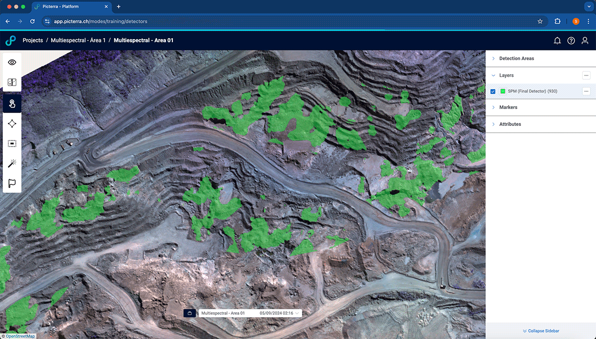
The first site required detailed geological mapping to identify saprolite of dunites (SPM), a lithology essential for assessing ground stability but complex to distinguish visually. Using Picterra, MecRoc trained a custom detector with multispectral imagery, achieving 74% accuracy. This automated process minimized fieldwork, reduced geologists’ and geotechnical engineers’ exposure to hazards, and guided more effective risk control measures by effectively delineating geomechanical zones in the slope design process.
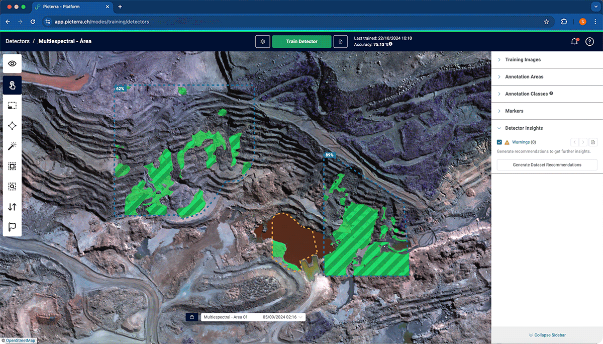
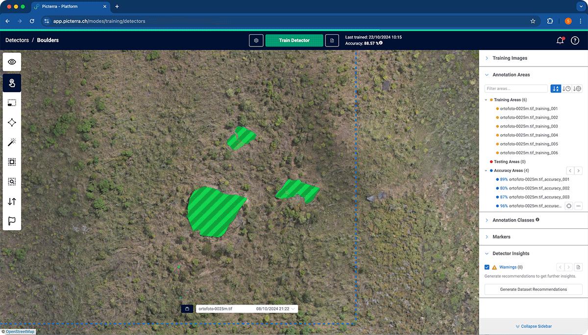
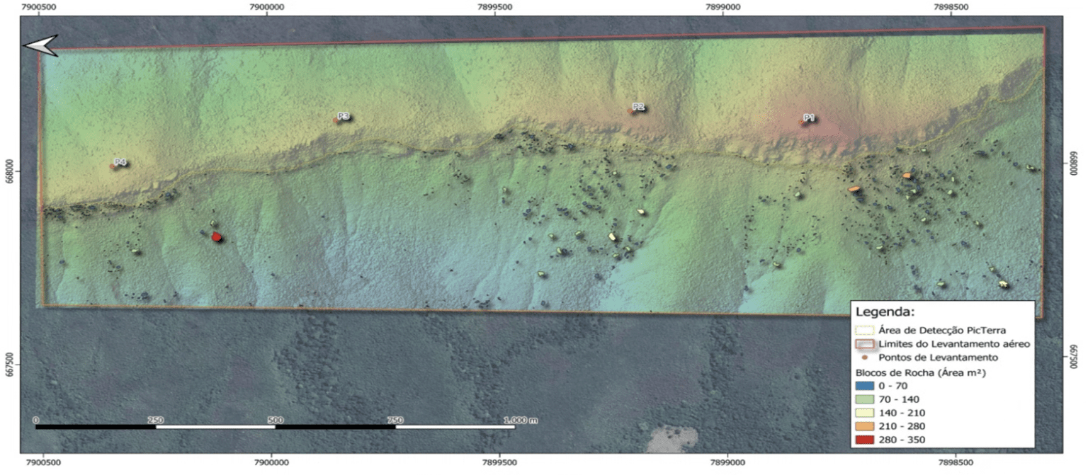
Rock boulder identification: The tool mapped rock boulders along ridges, helping operational teams implement hazard controls for safer equipment deployment and planning activities.
Cracks and erosion mapping: Picterra automated the detection of ground-related hazards such as cracks, erosion, and vegetation, aiding in identifying high-risk areas for targeted intervention.
A comparative study was conducted across these projects to assess the effectiveness of RGB (red, green, and blue color model) versus multispectral imagery. Surprisingly, RGB data achieved higher detection accuracy (78.4%), challenging assumptions about the superiority of multispectral data. The analysis highlighted the practicality and cost-effectiveness of simpler, widely available RGB imagery for geotechnical applications.
Adjacent to the site in the previous example, Picterra supported regulatory compliance by monitoring slopes near protected areas. This included before-and-after comparisons to evaluate environmental impact and guide mitigation strategies.
These applications align with the critical steps of the hazard life cycle:
A key feature of Picterra is its ability to empower users to create custom detectors—specialized models designed to identify features or patterns in geospatial imagery. Geotechnical Engineers and MecRoc leveraged this capability to build geomechanical mapping and hazard detection models at several sites. Still, the platform’s intuitive workflow means anyone can replicate this process to address their unique needs.
Creating a detector is a straightforward yet robust process:
This accessible approach allows geotechnical engineers, or any other colleagues, to create their own detectors. Over time, as users build and refine detectors across various use cases, they pave the way for autonomous production workflows, enhancing efficiency and safety at scale.
The adoption of GeoAI in these projects has brought measurable benefits to operational efficiency and safety:
Automated mapping minimizes the need for prolonged fieldwork in hazardous areas, such as unstable slopes or inaccessible regions.
GeoAI ensures systematic coverage, identifying areas of interest that might be missed with manual approaches.
Automated detectors streamline workflows, allowing geotechnical engineers to focus on refining outputs and conducting targeted risk mitigation work.
Geotechnical applications of GeoAI are particularly valuable for geotechnical risk management, where identifying ground-related hazards and monitoring dynamic changes are critical. For example:
The success of these projects demonstrates the potential for expanding GeoAI’s applications within the global mining company. Future use cases could include environmental monitoring, vegetation mapping, and real-time hazard assessments. As hyperspectral data becomes more accessible, it may further enhance GeoAI’s capabilities for advanced geological analysis for grade control purposes and accurate geomechanical modeling for slope design optimization.
GeoAI represents an opportunity to refine and enhance existing workflows while reducing risk and improving efficiency. By integrating platforms like Picterra, mining companies can continue to lead the way in leveraging cutting-edge technology to keep their people safe while unlocking maximum value.
