Turning regenerative agriculture into measurable progress with GeoAI
From ambition to measurable regeneration Regenerative agriculture has moved from a promising concept to a strategic priority for companies working...


From ambition to measurable regeneration Regenerative agriculture has moved from a promising concept to a strategic priority for companies working...
From compliance to collaboration At this year’s World Coffee Innovation Summit in London, Picterra and Planet shared the stage to...

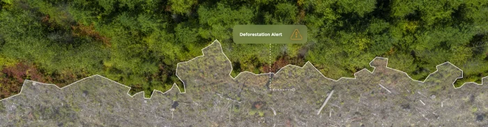
For years, biodiversity sat just outside the core of most corporate sustainability strategies. It was acknowledged but rarely measured, recognized...
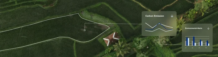
Carbon markets were created to make climate action more scalable. By assigning financial value to emissions reductions and carbon storage,...