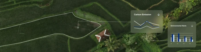
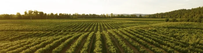
Turning regenerative agriculture into measurable progress with GeoAI
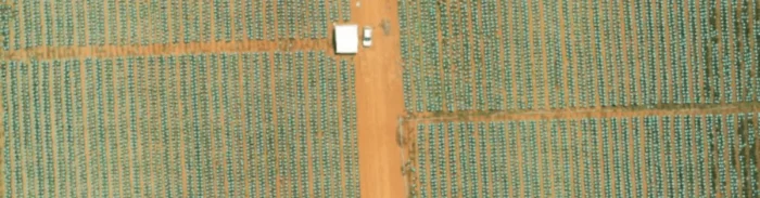
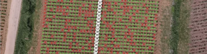
From ambition to measurable regeneration Regenerative agriculture has moved from a promising concept to a strategic priority for companies working...
From ambition to measurable regeneration Regenerative agriculture has moved from a promising concept to a strategic priority for companies working...
From compliance to collaboration At this year’s World Coffee Innovation Summit in London, Picterra and Planet shared the stage to...
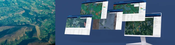
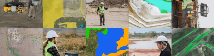
What is GeoAI? Understanding geospatial artificial intelligence GeoAI, short for geospatial artificial intelligence, involves using AI techniques like machine learning...
For years, biodiversity sat just outside the core of most corporate sustainability strategies. It was acknowledged but rarely measured, recognized...
Carbon markets were created to make climate action more scalable. By assigning financial value to emissions reductions and carbon storage,...

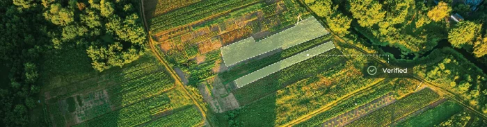
Sustainability compliance used to revolve around documentation. Was a certificate available? Could a supplier confirm something in writing? Was an...
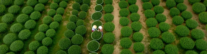
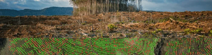
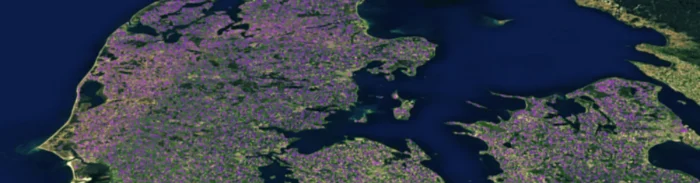
Regenerative agriculture is no longer just a fringe idea. Once regarded as a niche approach championed by a handful of...

Lausanne, Switzerland – May 14, 2025 – Picterra, a leading platform for geospatial artificial intelligence (GeoAI), today announced the availability of its solution...
For many sustainability leaders, compliance has long been the primary focus: tick the box, pass the audit, and move on.But...
Trust in corporate sustainability claims has significantly declined. An increasing number of scandals and lawsuits are prompting everyone—inclusive of investors,...
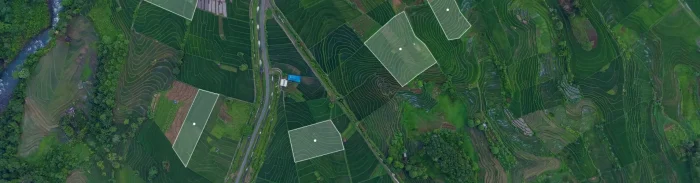
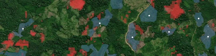
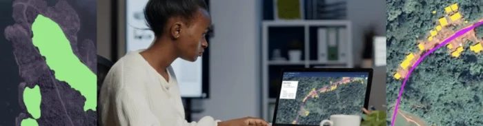
Organizations are navigating an unprecedented influx of geospatial data in today's fast-evolving compliance and sustainability landscape. The need for clean,...

Lausanne, Switzerland – December 3, 2024 – Picterra, a leader in GeoAI, and Planet Labs PBC (NYSE:PL), a leading provider of Earth data, have...
Comprehensive geospatial solution streamlines compliance, verification, and sustainability monitoring across multiple industries Lausanne, Switzerland – November 7, 2024 – Picterra, a...

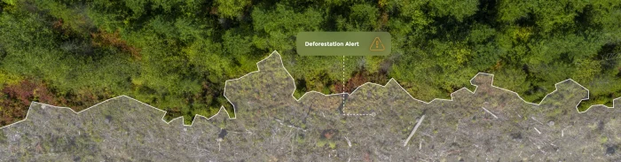
The European Commission has proposed a 12-month delay in implementing the EU Deforestation Regulation (EUDR), citing the need for additional...

Lausanne, Switzerland, October 8, 2024 – Picterra, a leading provider of geospatial artificial intelligence (GeoAI) software, is pleased to announce that it...
In an era where information is abundant but often elusive, the ability to uncover hidden truths has never been more...

Lausanne, Switzerland, July 29, 2024 – Picterra, the leading provider of geospatial AI enterprise software was successfully approved by the...
This week, we have released a set of features that further improve how change detection works within the Picterra platform....
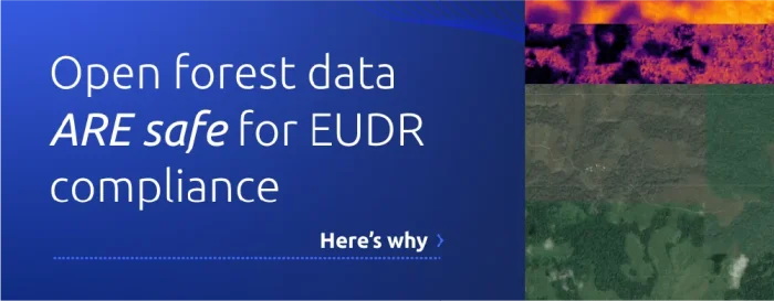
In the rapidly evolving European Union Deforestation Regulation (EUDR) landscape, ensuring compliance with its forward-thinking environmental standards is a top...
Step outside your home, and you're likely surrounded by trees, whether you are living in an urban or rural environment....

Southeast Asia has one of the highest rates of deforestation, at about 1.2% every year, which causes significant environmental damage....

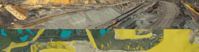
Mining is an industry of great importance, significantly contributing to global economic development. However, it struggles with efficiency, safety, and...
The mining industry is a cornerstone of the global economy, constantly seeking optimization to remain competitive and sustainable in a...

The fusion of technology and industry is an evolving narrative that continues to revolutionize our world. The mining sector, a...

Did you know that the effective use of geospatial data analytics in the mining industry can lead to a potential 10-15%...
Please note that this article was originally written in April 2023. Since then a lot has changed with the EUDR....
The mining industry is a cornerstone of modern society, providing essential raw materials for everything from smartphones to skyscrapers. However,...
Did you know that incorporating geospatial data in mining operations can lead to a 10-15% reduction in exploration costs? The...

The increasing urgency of climate change and environmental degradation has underscored the importance of sustainable business practices. To mitigate their...

What is Mining 4.0? Mining 4.0 refers to integrating Industry 4.0 technologies into the mining industry. Industry 4.0 is a...

Picterra joins WGIC to advance geospatial engagement & collaborationLausanne, Switzerland, January 16, 2023 – Picterra, the leading provider of geospatial...

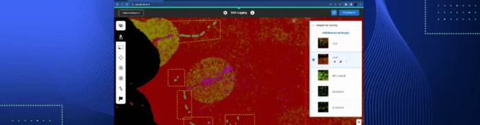
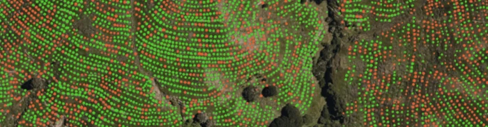
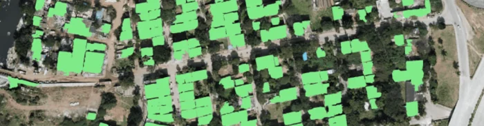
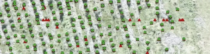
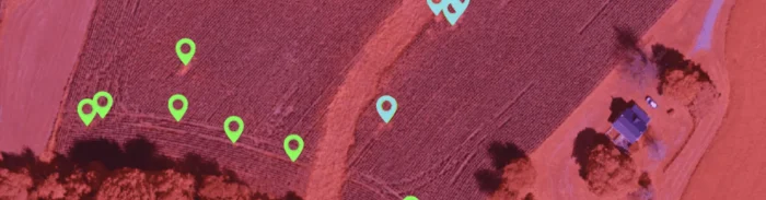
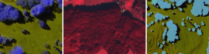
Picterra's powerful machine learning algorithms can be used to quickly detect objects, patterns, and changes in Earth Observation imagery, be...

Lausanne, Switzerland, October 13, 2022 – Picterra, the leading provider of geospatial machine learning software, today announced their Add-In for Esri ArcGIS...

50% of the world’s gross domestic product (GDP) is dependent on nature and biodiversity. With the current world GDP at nearly...

Lausanne, Switzerland, September 06, 2022 – Picterra, the leading provider of geospatial machine learning software, today announced they have become a Silver...
This article was written and produced by SGS and was originally published here on January 4th 2021.The negative effects of illegal logging are well...
Geospatial data is in a unique position to positively impact Environmental, Social, and Governance (ESG) goals around the world. It’s...
Lausanne, Switzerland, 26 April, 2022 – Picterra, the leading provider of geospatial machine learning software, today announced the closing of a $6.5M...

Note: This content reflects Picterra’s perspectives and product features at the time of writing, which may have since changed.The whole...

Note: This content reflects Picterra’s perspectives and product features at the time of writing, which may have since changed.Evaluating performance...
Note: This content reflects Picterra’s perspectives and product features at the time of writing, which may have since changed.In order...
Note: This content reflects Picterra’s perspectives and product features at the time of writing, which may have since changed.Since its...
Note: This content reflects Picterra’s perspectives and product features at the time of writing, which may have since changed.Building detection...
Note: This content reflects Picterra’s perspectives and product features at the time of writing, which may have since changed. Country...
Note: This content reflects Picterra’s perspectives and product features at the time of writing, which may have since changed.Thanks to geospatial...
Note: This content reflects Picterra’s perspectives and product features at the time of writing, which may have since changed.Our world...
Note: This content reflects Picterra’s perspectives and product features at the time of writing, which may have since changed. Start...
Note: This content reflects Picterra’s perspectives and product features at the time of writing, which may have since changed.The use...
Note: This content reflects Picterra’s perspectives and product features at the time of writing, which may have since changed. Machine...
Organization announces expansion plans at INTERGEO, the world's premier geospatial event. Lausanne, Switzerland – September 17, 2019 – Picterra, a geospatial software...
Note: This content reflects Picterra’s perspectives and product features at the time of writing, which may have since changed.Read on...
Note: This content reflects Picterra’s perspectives and product features at the time of writing, which may have since changed. Machine...
Note: This content reflects Picterra’s perspectives and product features at the time of writing, which may have since changed. Precision...