Environmental intelligence for mining

Mission Control for sustainable, safe, and responsible mining

Manage your environmental footprint, identify risks early, and improve safety with Picterra’s autonomous GeoAI analytics to give you full control at scale.

Mining faces a dual challenge: achieving growth while safeguarding the environment and communities. The challenge is clear: how can mining balance performance with responsibility?

Regulators, investors, and communities demand transparency on land use, the impact of operations on surrounding nature and biodiversity, and the creation of safe working environments. Traditional monitoring is fragmented, costly, and slow, with siloed data and blind spots that make it hard to see the full picture.

Continuous insight. Precise control.
Scalable impact.

Focus where it matters most

Transform complex geospatial data into clear, real-time insights that cut through noise and uncertainty.

Stay ahead of risk

Proactively address environmental impacts and operational hazards throughout every stage of the mine lifecycle.

Prove responsibility with evidence

Demonstrate compliance, enhance ESG reporting, and build trust with regulators, investors, and communities.

Mission Control for environmental intelligence in mining

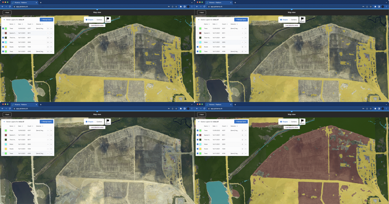
Picterra integrates advanced GeoAI and automation with satellite and aerial imagery to give mining companies continuous, high-resolution oversight and ongoing visibility into their sites and surrounding areas. With Picterra, you can monitor environments, identify hidden risks, and respond to significant changes across crucial zones.

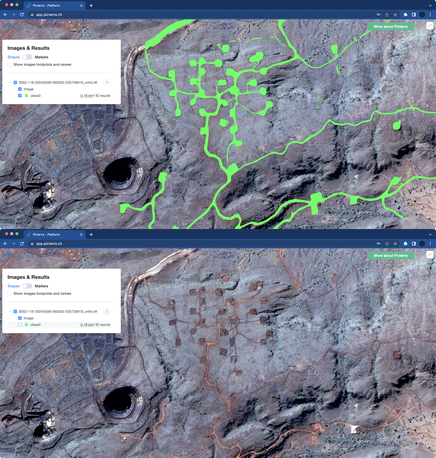
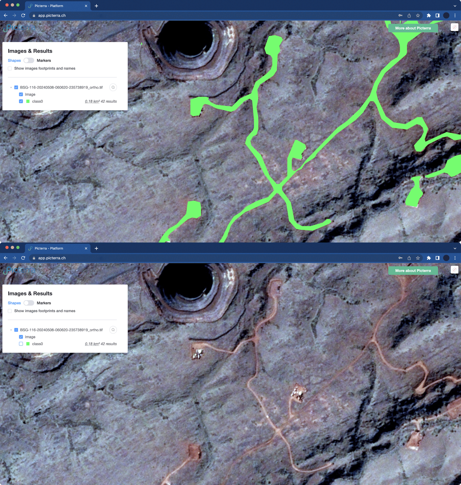
An aerial satellite view, processed with the Picterra geospatial platform, of a rocky, arid mining landscape is presented. A central area features a cluster of bright green polygons, each about 0.01 hectares, connected by green line segments. In the upper left-hand corner, an "Images & Results" panel displays a list of layers, including a checked "Image" layer and a checked "class0" layer with 42 results, along with options for "Shapes," "Markers," and "Show images footprints and names." A large open-pit mine is visible on the left side, and a "More about Picterra" button is situated in the upper right-hand corner.

Environmental impact management

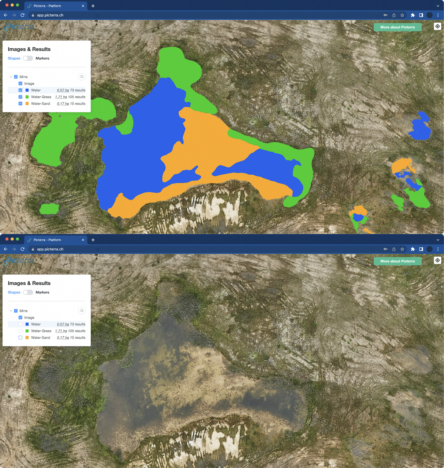
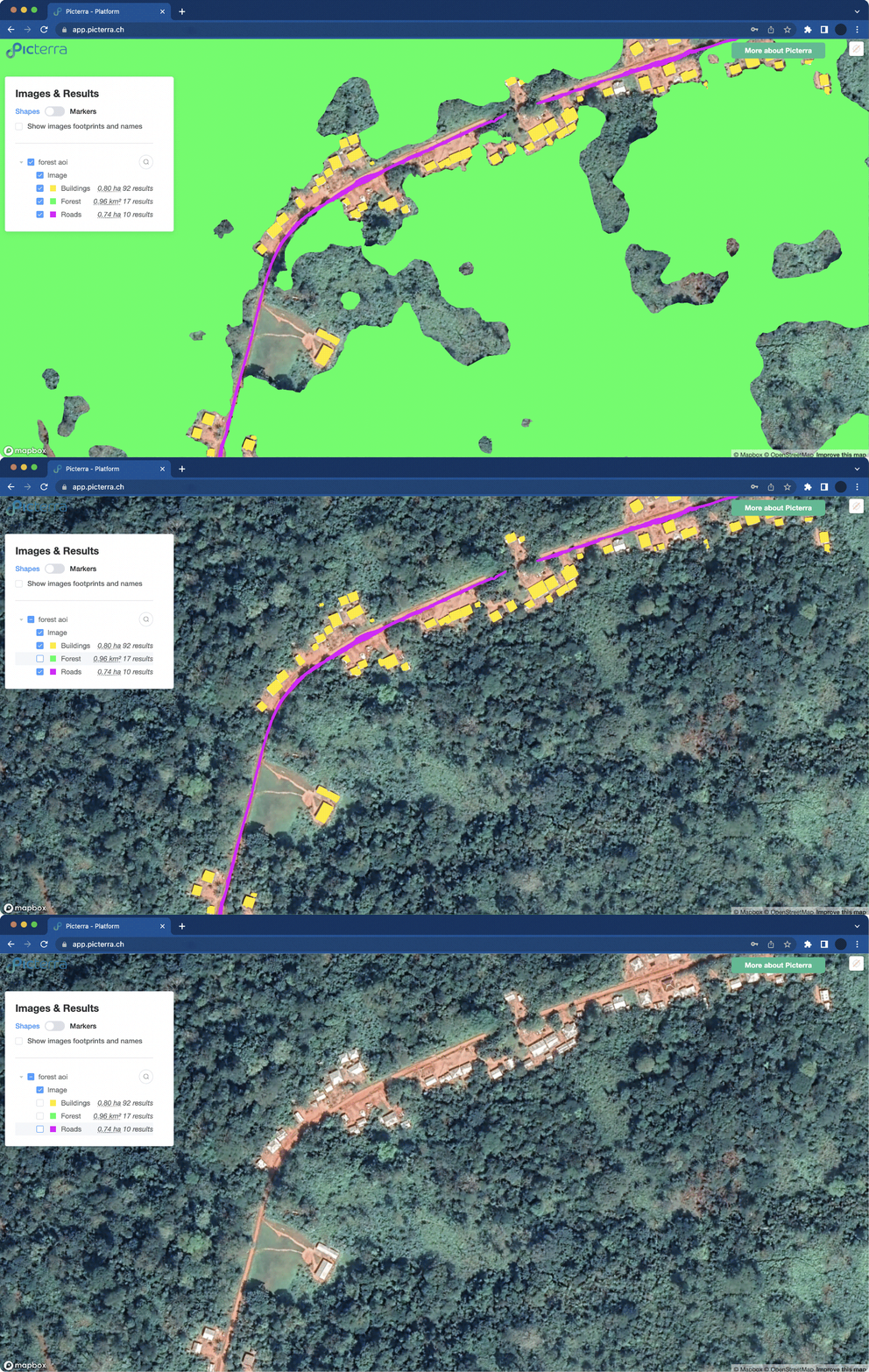
Understand and reduce the impact of your operations. By monitoring land use change, water resources, and biodiversity, Picterra helps ensure mine development and closure leave behind healthier ecosystems, along with verifiable evidence of successful rehabilitation.

Environmental risk management and safety

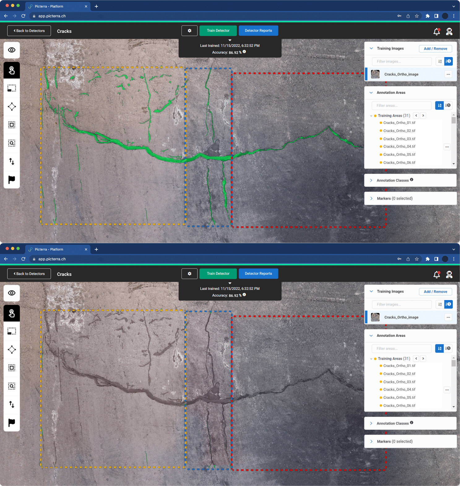
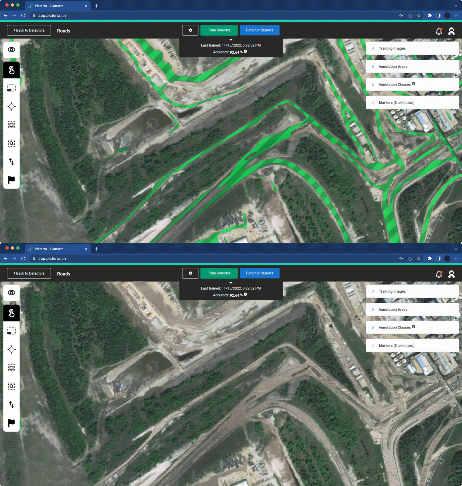
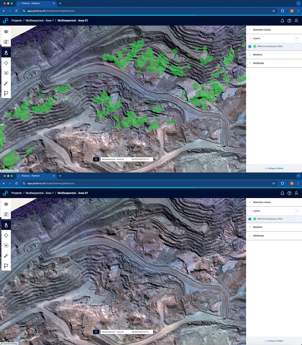
Protect people, infrastructure, and assets through automated, systematic detection of safety hazards. Picterra monitors water bodies, haul roads, and other logistic infrastructure while identifying cracks, slope instabilities, and ground-related risks. Early-warning insights help reduce accidents, enhance resilience, and lower costs for managing geotechnical hazards throughout the mine’s lifecycle.

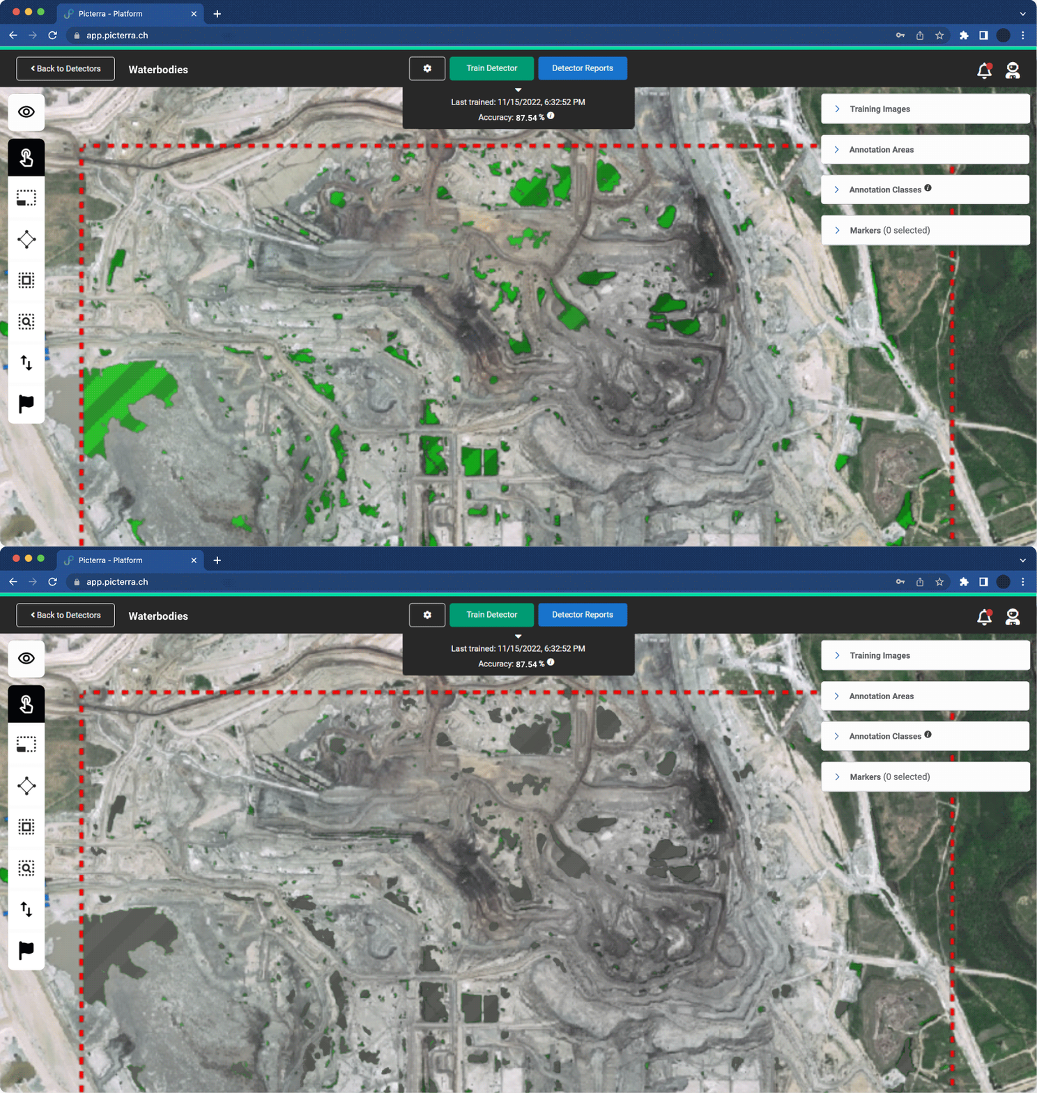
This image showcases the Picterra detector training interface applied to an industrial or mining site. Within a red dashed annotation area, several bright green polygons highlight identified "Waterbodies" across the excavated terrain. The top dashboard indicates the AI model's performance, showing a training accuracy of 87.54% as of November 2022. The interface includes tools for training the detector, viewing reports, and managing annotation classes, demonstrating how machine learning is used to automate the monitoring of environmental features in complex industrial landscapes.
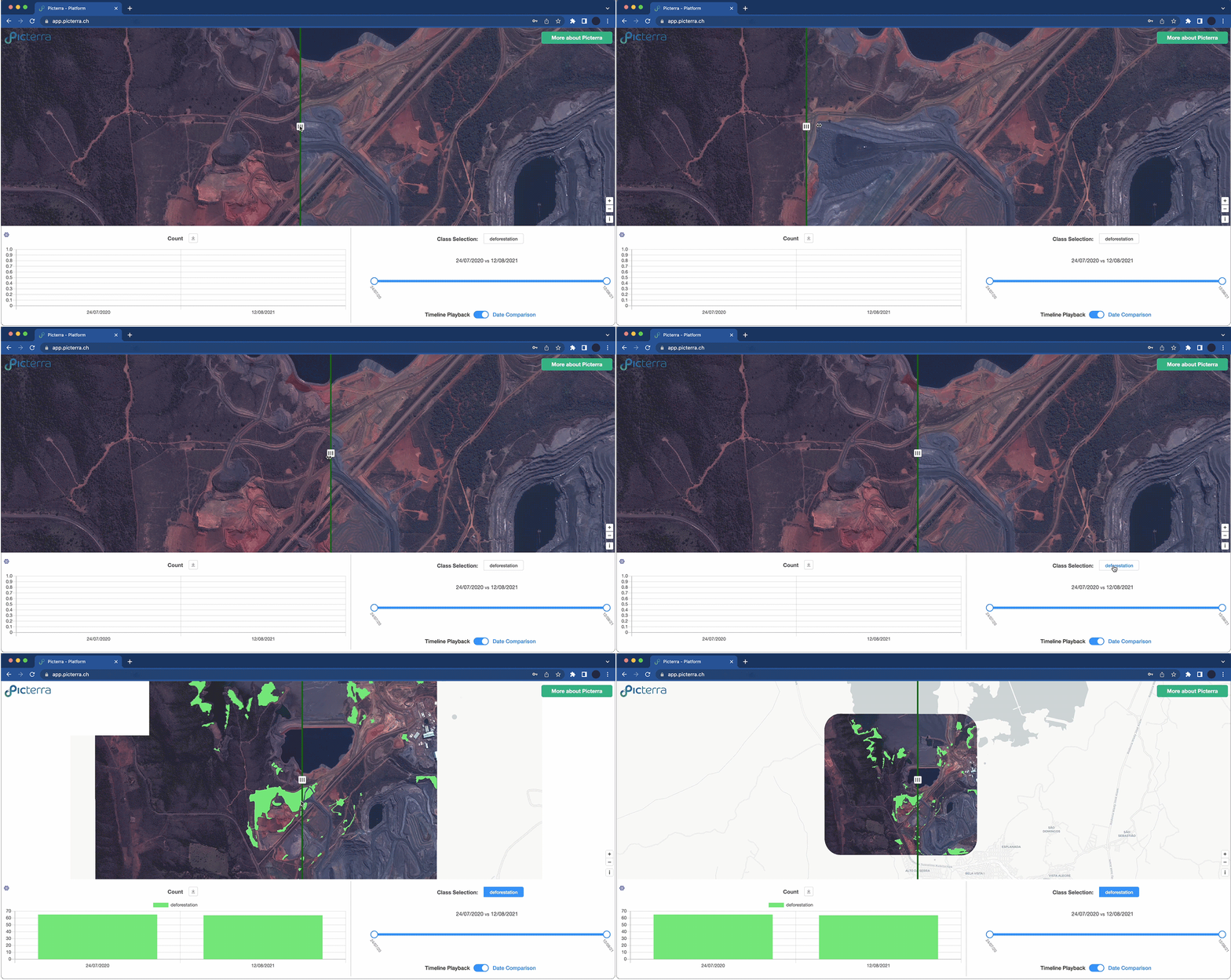
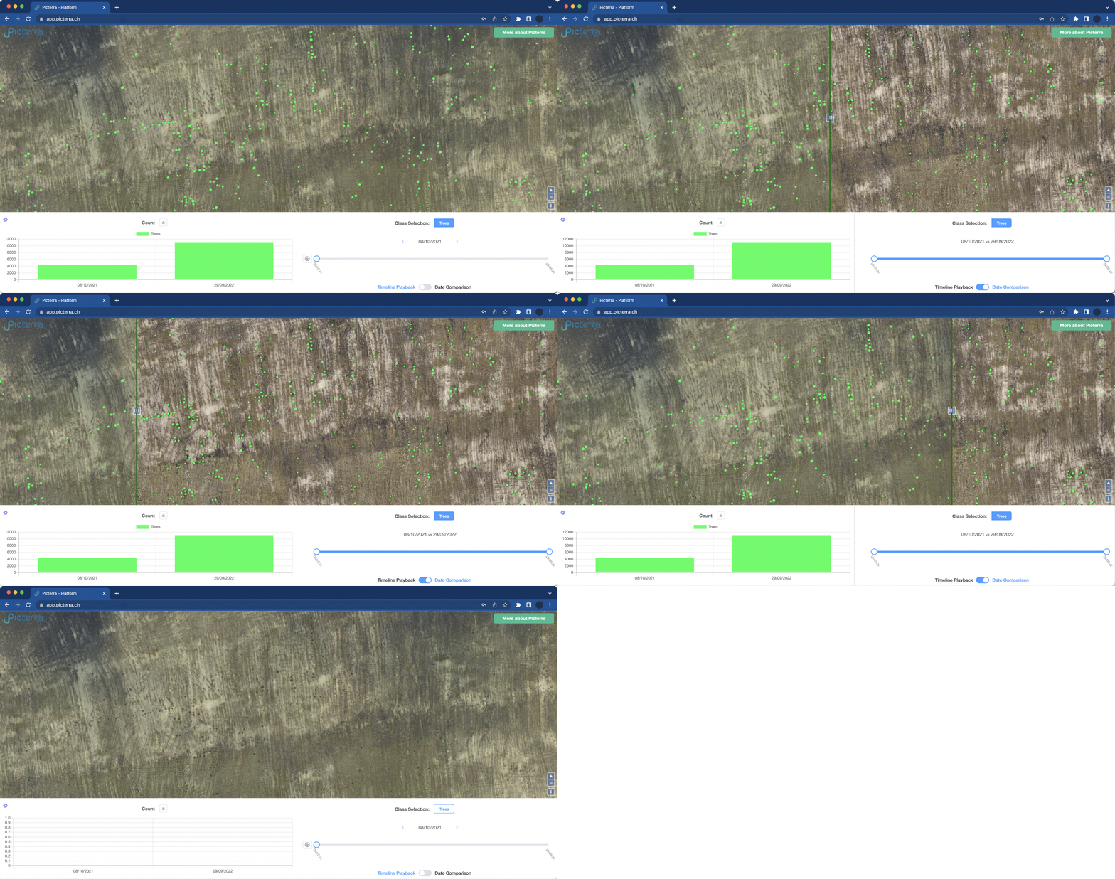
This image displays the Picterra platform's change detection interface monitoring a mining site. A vertical slider splits the satellite view, allowing for a direct side-by-side comparison of the landscape between two different dates. The dashboard below includes a "Count" graph and a timeline showing a comparison between July 2020 and August 2021. With the "Class Selection" set to deforestation, the tool illustrates how geospatial AI can be used to track environmental impact and land-clearing activities over time in industrial zones.

ESG, sustainability, and social governance

Show responsibility and meet increasing stakeholder expectations. Picterra provides transparent reporting aligned with ESG standards, helping you demonstrate reduced impact, stay compliant, and build trust with regulators, investors, and local communities.

Eramet’s journey with Picterra toward autonomous GeoAI solutions

Eramet partnered with Picterra to modernize geospatial data management and unlock autonomous environmental monitoring. By scaling advanced GeoAI across sites, Eramet improved efficiency and accuracy while strengthening oversight of exploration, rehabilitation, geotechnical risks, and water management.

Greater team autonomy

More users engaged directly with geospatial data, reducing reliance on central resources.

One platform, many solutions

Rapid deployment and seamless integration were achieved to address diverse geospatial needs.

Our technology

Picterra GeoAI at the core of mining intelligence

Behind Mission Control stands Picterra Forge, our foundational GeoAI that transforms geospatial data into ongoing environmental oversight and monitoring. The cloud-native machine learning platform offers the scale, accuracy, and independence needed to operate responsibly in today’s world.

One platform, infinite use cases

Seamlessly navigate through every stage of the mining life cycle with the power of advanced machine learning models and geospatial intelligence. Keep a streamlined flow of valuable insights at your disposal, under your control.

Custom-build, deploy, and act

Effortlessly create custom-built machine learning models to extract the information you need from your data. Whether it’s detecting cracks and erosion in mining sites, monitoring water bodies throughout the mine site, or tracking rehabilitation efforts, Picterra empowers you to effortlessly set up, maintain, deploy, and reuse these models.

Dedicated support for success

We go beyond just providing a platform. Our team offers expert services to accelerate your time to production and maximize your return on investment. From training models for specific areas of interest to addressing your unique requirements, we are committed to ensuring your success.

Create and deploy geospatial ML models at scale

With Picterra, you can create a scalable system to operate geospatial machine learning models in production and continuously develop them, catering to diverse mining use cases. Lead the way with powerful platform features and capabilities.

User-friendly, no-code model development, and instant production

Picterra provides a no-code platform to simplify machine learning. Its intuitive interface allows you to develop and train models with ease. Visualize your data clearly, and transition smoothly to instant production. With rapid iterations, you can adapt your AI solutions quickly to meet your changing needs. Picterra makes AI accessible, efficient, and user-friendly for everyone.
Easily work with any geospatial imagery type, format, and resolution to perform comprehensive data analysis. Whether it's optical, thermal, or radar imagery, digital elevation models, multi-spectral or hyperspectral data, or even sub-centimeter image resolution, Picterra enables you to handle it all with ease.
Picterra offers a comprehensive suite of innovative tools to curate your data, analyze model performance, and refine your models for optimal results. With these cutting-edge tools at your disposal, take your models to new heights of accuracy and quality.
Picterra seamlessly integrates into your established workflows, maximizing the value of your mining data. Our API enables you to automate a wide range of tasks, from uploading georeferenced images from local or remote servers, importing object annotations or detection areas, exporting detection results into other software, or embedding them into customized dashboards. Learn more about Picterra's integrations

Discover the key applications of Picterra in solving mining challenges

Ready to take control of your environmental intelligence?

Talk to our team and see how Picterra empowers mining companies to monitor environments, reduce geotechnical risks, and meet ESG goals.