Environmental intelligence for regenerative agriculture & farming

Mission Control for regenerative and resilient agriculture

Picterra helps farmers, suppliers, and sustainability teams monitor regenerative practices, improve yields, and build resilience. By transforming satellite and drone imagery into verifiable evidence, our platform gives you visibility and control across entire farming networks.

Agriculture is under pressure. Rising costs, climate stress, and supply chain disruption make it harder to sustain livelihoods while producing more food.

Traditional methods such as field audits and manual surveys are slow, costly, and unreliable at scale. As regenerative practices and carbon-smart farming expand, the need for trusted and scalable monitoring has never been greater.

Better yields, healthier soils, credible reporting

Support regenerative practices

Track soil cover, shade trees, and crop rotations to verify the adoption and impact of regenerative agriculture.

Reduce risk and waste

Detect weeds, pests, and erosion early so farmers and suppliers can act before they cause yield loss or long-term soil damage.

Build trust with evidence

Generate verifiable data for supply chains, certifications, and EUDR compliance to prove progress toward sustainable agriculture.

Mission Control for environmental intelligence in agriculture

Picterra combines GeoAI with satellite and drone imagery to help farmers, suppliers, and sustainability leaders monitor land, crops, and regenerative practices continuously and at scale. With Picterra, you can build resilience, improve productivity, and demonstrate real progress toward sustainable agriculture.

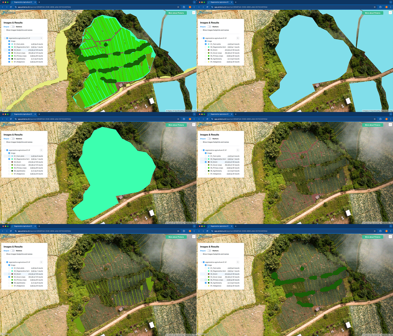
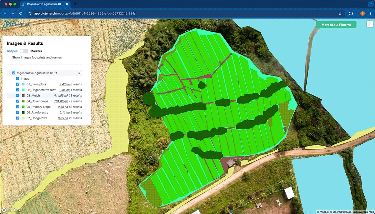
Visualize the future of sustainable farming with this screenshot from Picterra. The image displays an aerial analysis of a Regenerative Agriculture farm. It highlights key features of regenerative practices with classified polygons for mulch, cover crops, agroforestry, and hedgerows, plus detailed data on field area and result counts. This tool enables precise monitoring and measurement of regenerative farm metrics using satellite imagery and computer vision.

Regenerative practice monitoring

Track cover crops, shade trees, and soil health indicators to measure the adoption of regenerative practices and their impact over time.

Crop and livestock intelligence

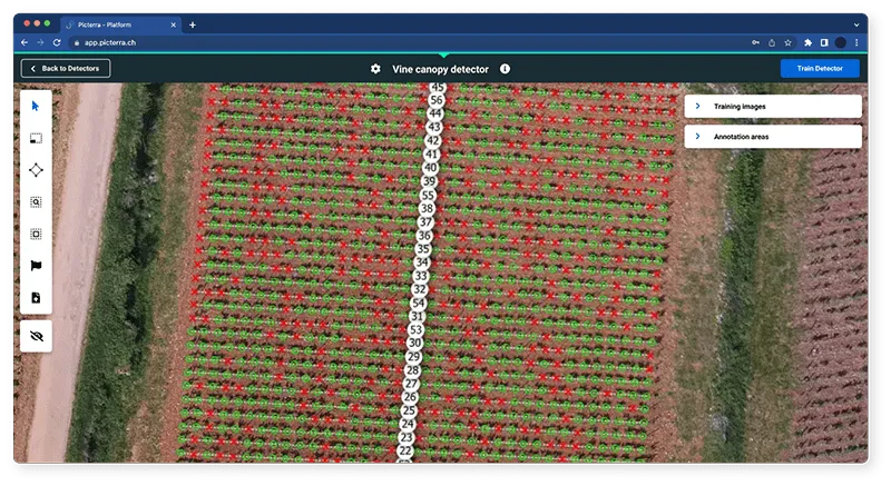
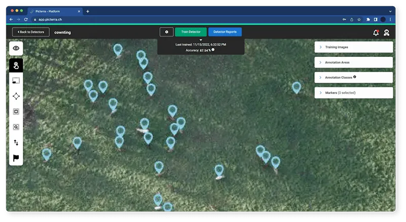
Automate crop classification, detect harmful weeds, monitor vineyard health, and count livestock with high accuracy to save time and reduce reliance on manual surveys.

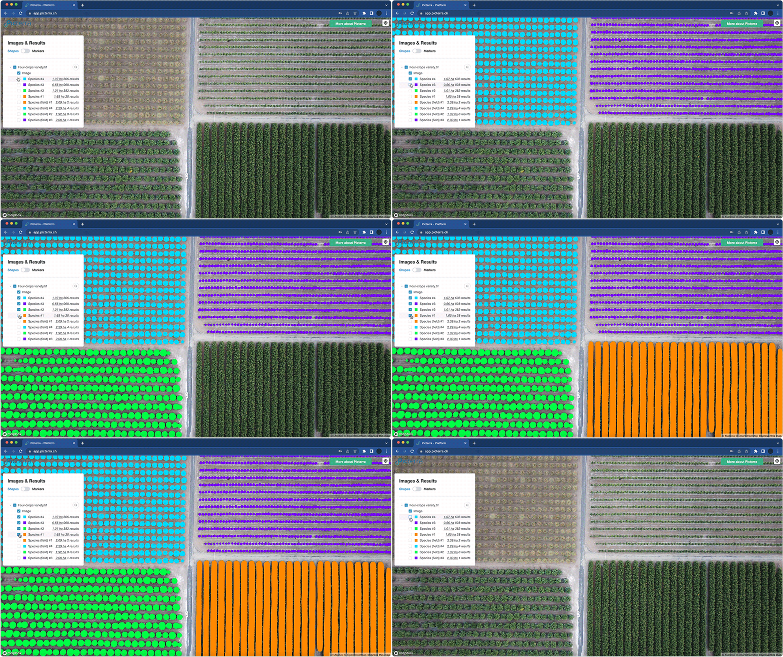
This is a screenshot of the Picterra geospatial platform displaying an aerial, top-down analysis of a field divided into four quadrants. The interface features a side panel titled "Images & Results" that lists data for a file named "Four-crops variety.tif." The analysis identifies and quantifies four different plant species and their corresponding fields, providing specific measurements in hectares (ha) and total object counts. The image illustrates how AI and satellite imagery are used to differentiate and monitor various crop types within a single agricultural plot.
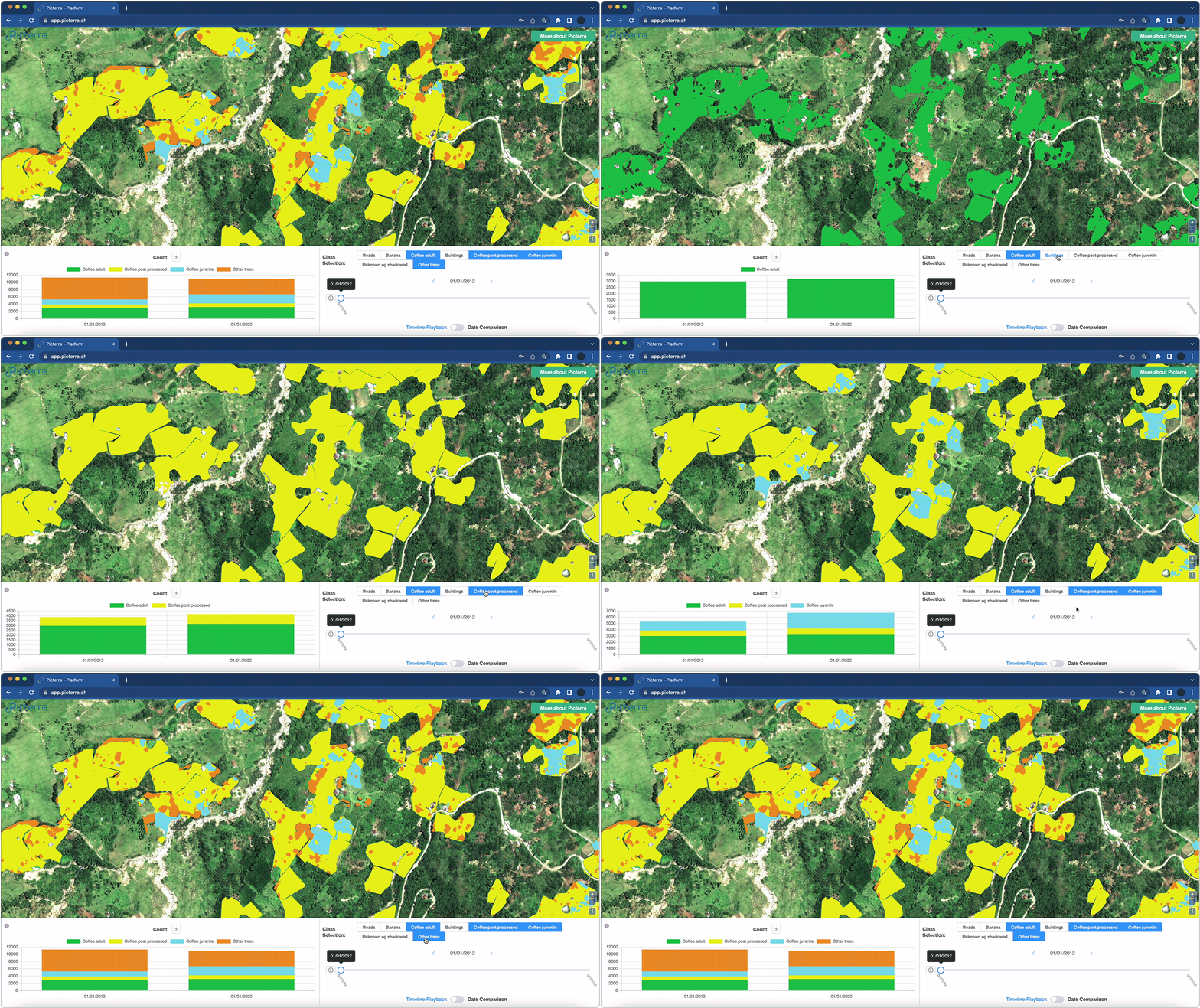
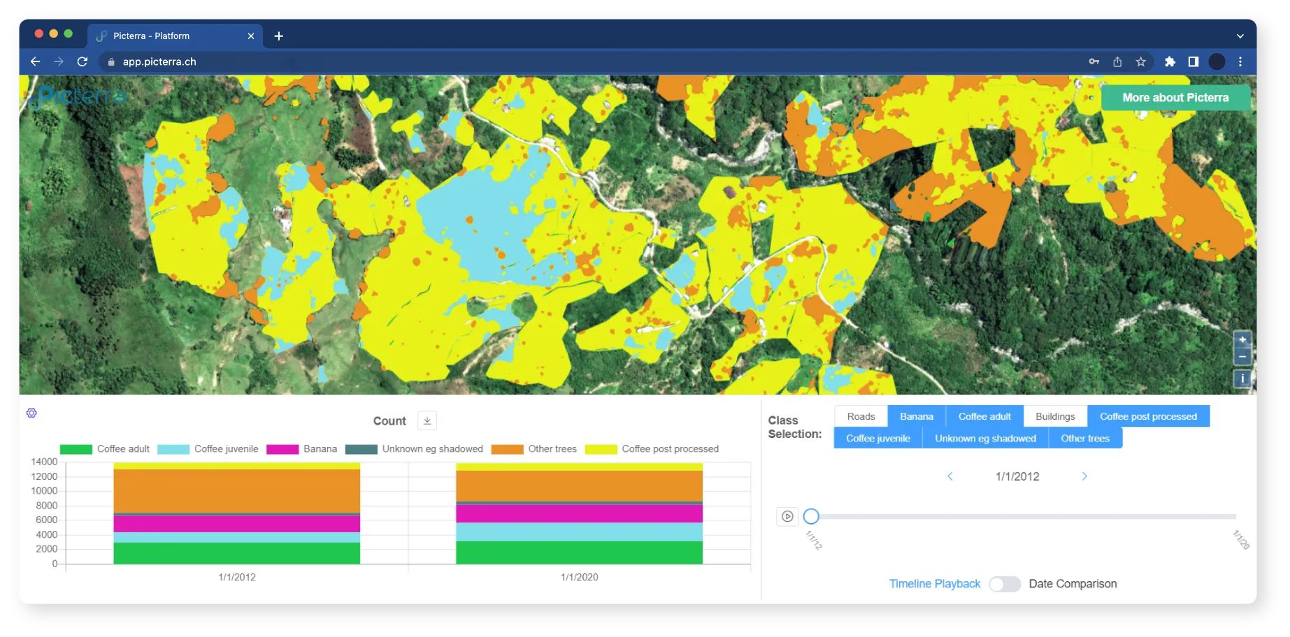
This image shows the Picterra platform dashboard featuring a satellite view of a lush, mountainous landscape. The interface includes a time-series analysis tool with a "Count" line graph tracking data from 2012 to 2020. A Class Selection menu allows users to filter results by categories like "Coffee adult," "Banana," "Buildings," and "Roads." The bottom panel also features a timeline slider and a "Date Comparison" toggle, illustrating the platform's capability for change detection and agricultural monitoring over time.

Sustainability and compliance

Strengthen supply chain traceability and meet requirements such as EUDR by generating transparent, audit-ready data on land use, farm boundaries, and natural capital.

Eagle Eye Imaging detects harmful weeds with Picterra

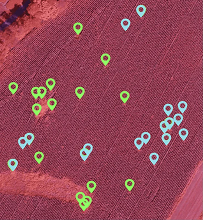
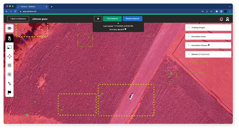
Eagle Eye Imaging used Picterra’s GeoAI to identify invasive weeds like Shattercane and Johnsongrass in US cornfields. What once required days of manual image review now takes less than an hour, with higher accuracy and scalability.

Faster, more accurate detection

Drone imagery processed with Picterra pinpoints invasive weeds quickly and reliably across large fields.

Smarter interventions

Farmers can focus treatments where they are needed most, reducing herbicide use and protecting crop yields.

Our technology

Technology and expertise tailored for agriculture

Picterra’s solutions help farmers, suppliers, and sustainability leaders strengthen resilience, scale regenerative practices, and meet compliance demands.

Picterra Forge

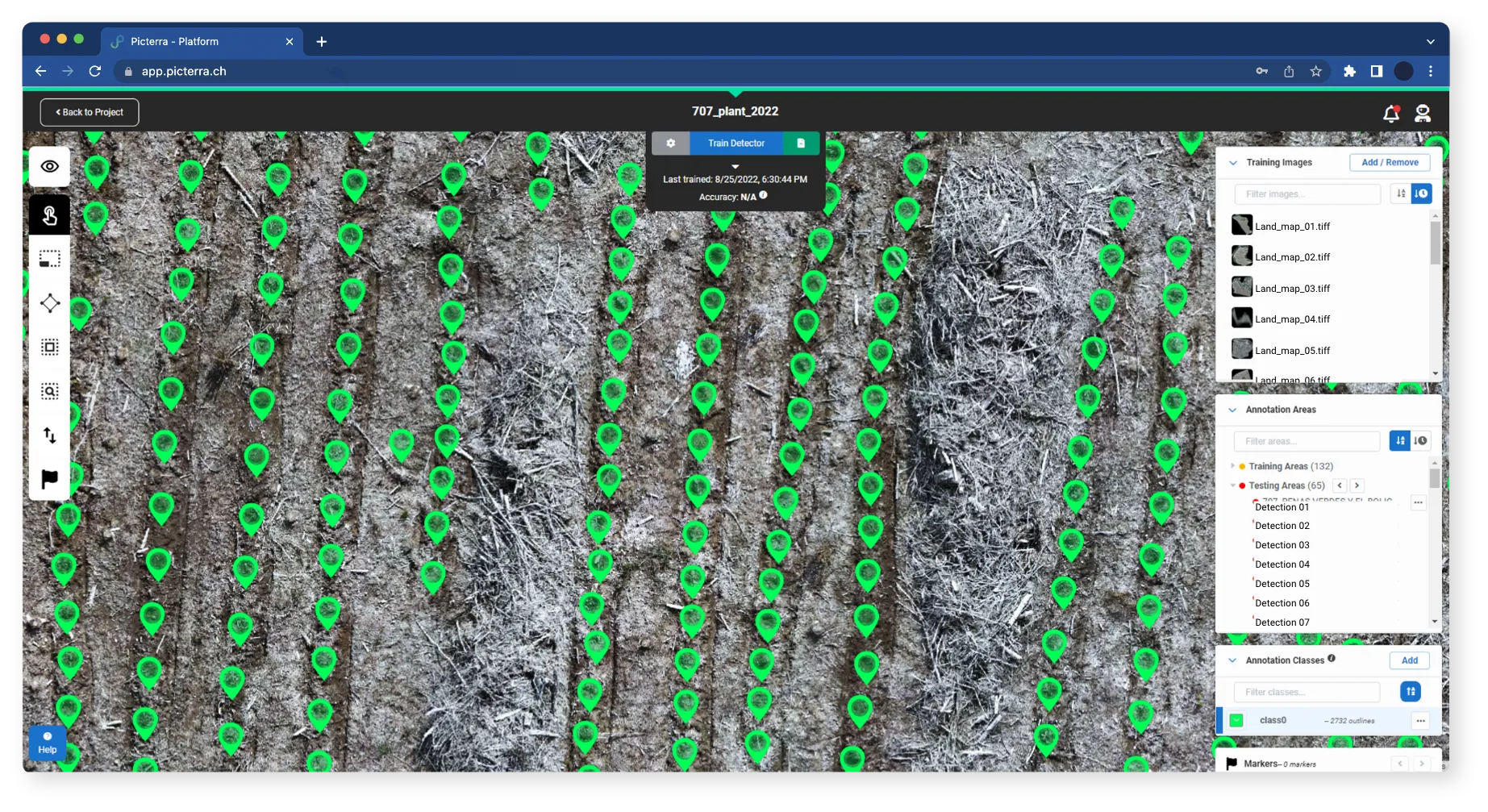
Build custom GeoAI models to detect weeds, track crop health, count livestock, and monitor soil and canopy cover.

Picterra Tracer

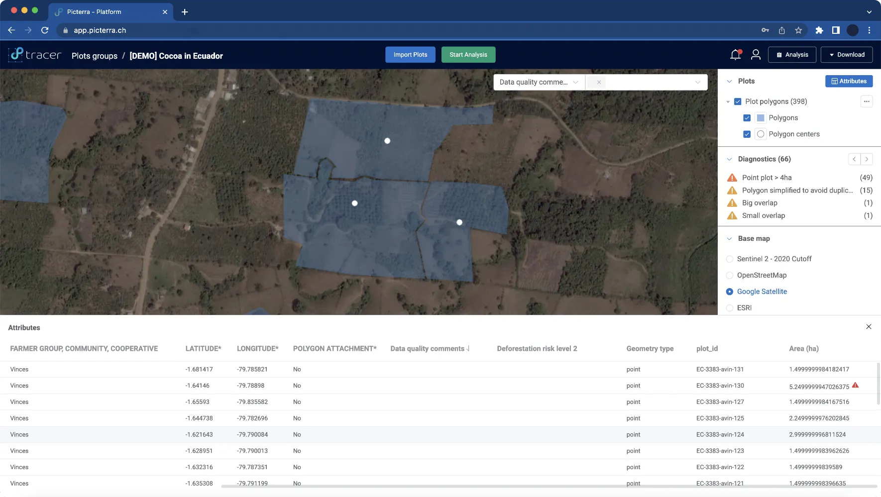
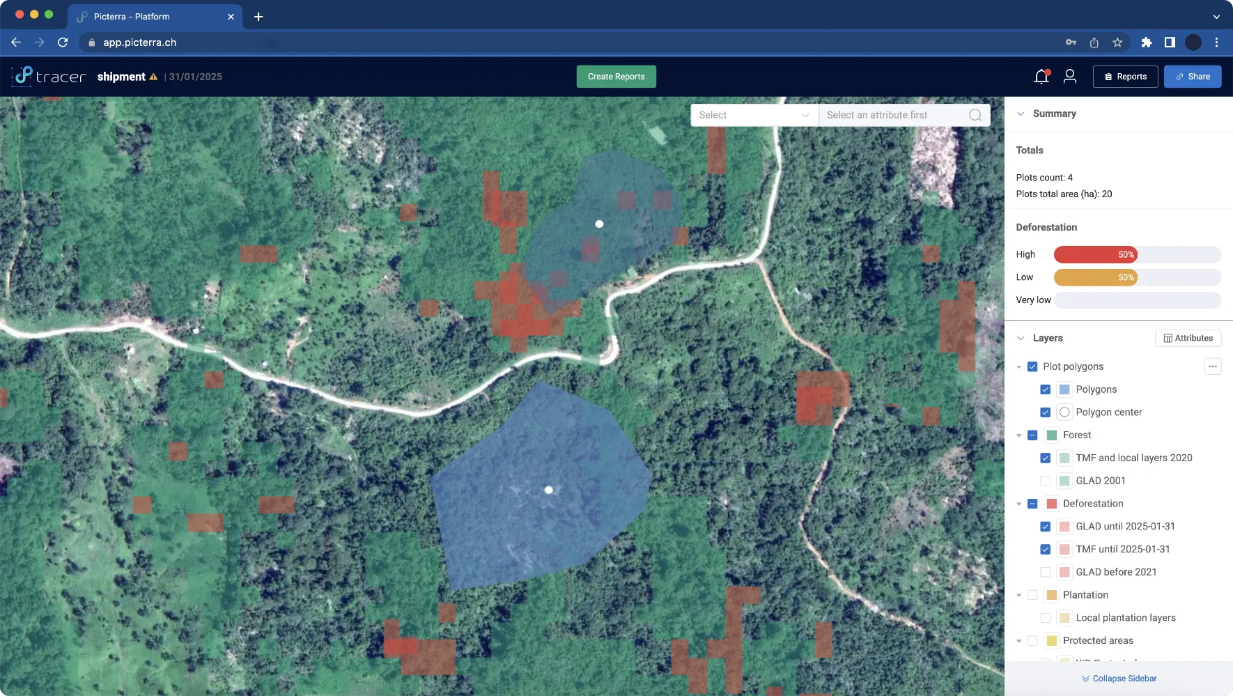
Verify EUDR compliance and regenerative agriculture claims with transparent, audit-ready reports that cover plots, farms, and sourcing regions.

Picterra Accelerate

Work with our experts to scale monitoring across thousands of farms, from pilot projects to global regenerative farming programs.

Discover the key applications of Picterra in regenerative agriculture and farming

Ready to scale regenerative agriculture with confidence?

Talk to our team about how Picterra can help you monitor practices, improve resilience, and generate verifiable evidence for farmers, suppliers, and regulators.