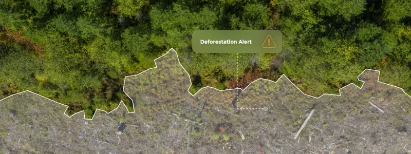
Verify every plot, monitor continuously, and turn fragmented supplier data into audit-ready evidence for EUDR, SBTi FLAG, and your own deforestation-free and conversion-free commitments.
Deforestation compliance now reaches plot level, and it determines whether goods can move across borders. Organizations are expected to demonstrate deforestation-free sourcing across supply chains built on thousands of smallholder farms, with supplier data that is often fragmented, self-reported, and difficult to standardize. Periodic audits and sampled field visits can’t cover every plot, every season, and the biggest exposures often sit outside the declared footprint entirely. Raw alert feeds don’t solve this either: a tree-cover-loss alert can be a plantation harvest, a fire, or genuine forest clearing, so teams are left defending decisions they can’t fully substantiate.
As a result, sustainability and sourcing teams are left asking:
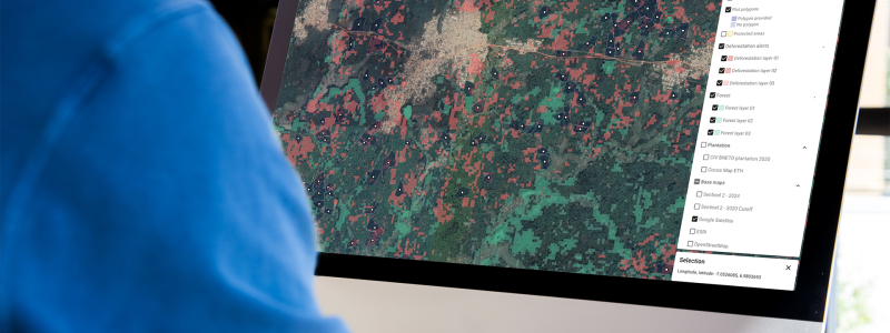
Import plot data from shapefiles, spreadsheets, or ESG systems. Insights Hub automatically checks geometry, attributes, and consistency, scoring data quality on ingestion so every analysis starts from a reliable foundation.


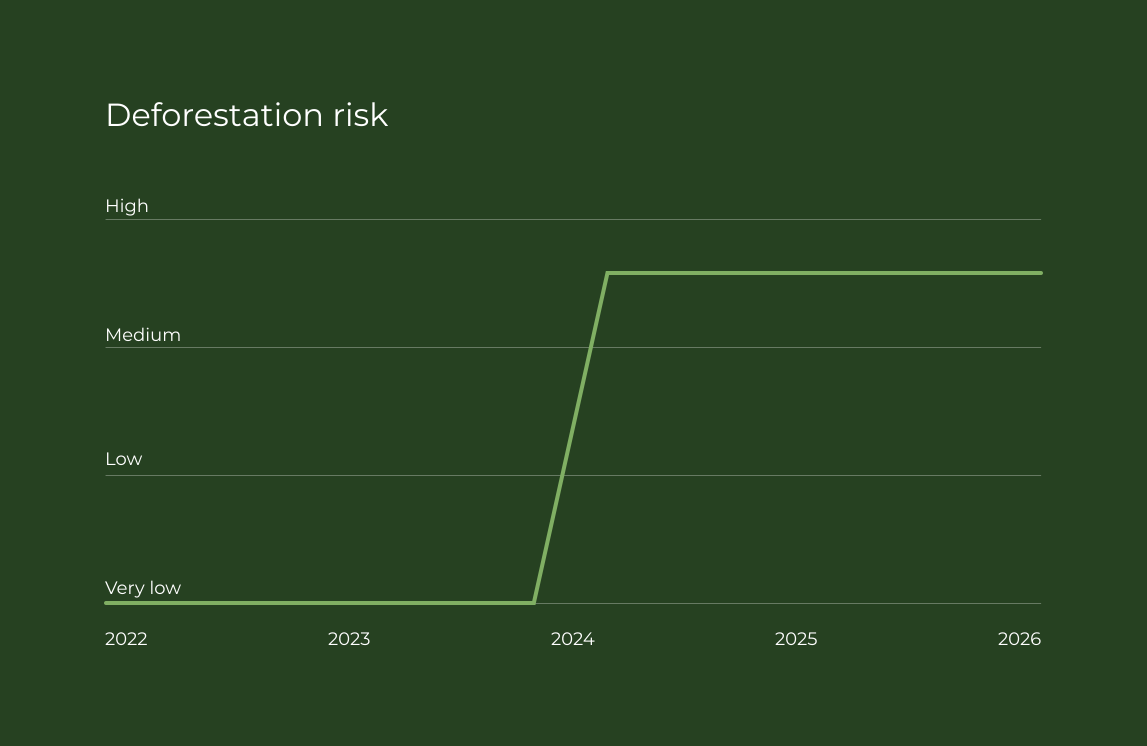
GeoAI models detect deforestation, land-use change, and buffer-zone breaches at plot level, using up-to-date imagery refreshed as new data becomes available rather than one-off snapshots. Monitoring extends beyond registered plots to the surrounding landscape, flagging early signals like new roads and clearings that typically precede deforestation. A convergence of evidence across multiple independent forest and plantation layers confirms each finding, so an alert is verified as genuine deforestation rather than a plantation harvest or a fire before it reaches your risk assessment.
Generate time-stamped, geolocated evidence for every plot. Export reports or integrate them directly into traceability platforms, sustainability tools, and regulatory submissions, including TRACES-ready outputs for EUDR.

Insights Hub combines continuous satellite observation, recognized deforestation and land-cover datasets, and your own supplier data into a single intelligence layer, providing consistent, plot-level insight from data ingestion to regulatory submission.
Validate and score geolocation data on ingestion, and map or correct plot boundaries automatically where supplier polygons are missing or unreliable.
Monitor the landscape around registered plots and flag early signals of conversion, such as new roads and clearings, before deforestation reaches your supply chain.
Monitor every plot for deforestation, forest degradation, and conversion throughout the year, not just at reporting time.
Screen sourcing locations against protected areas and detect buffer-zone breaches as they occur.
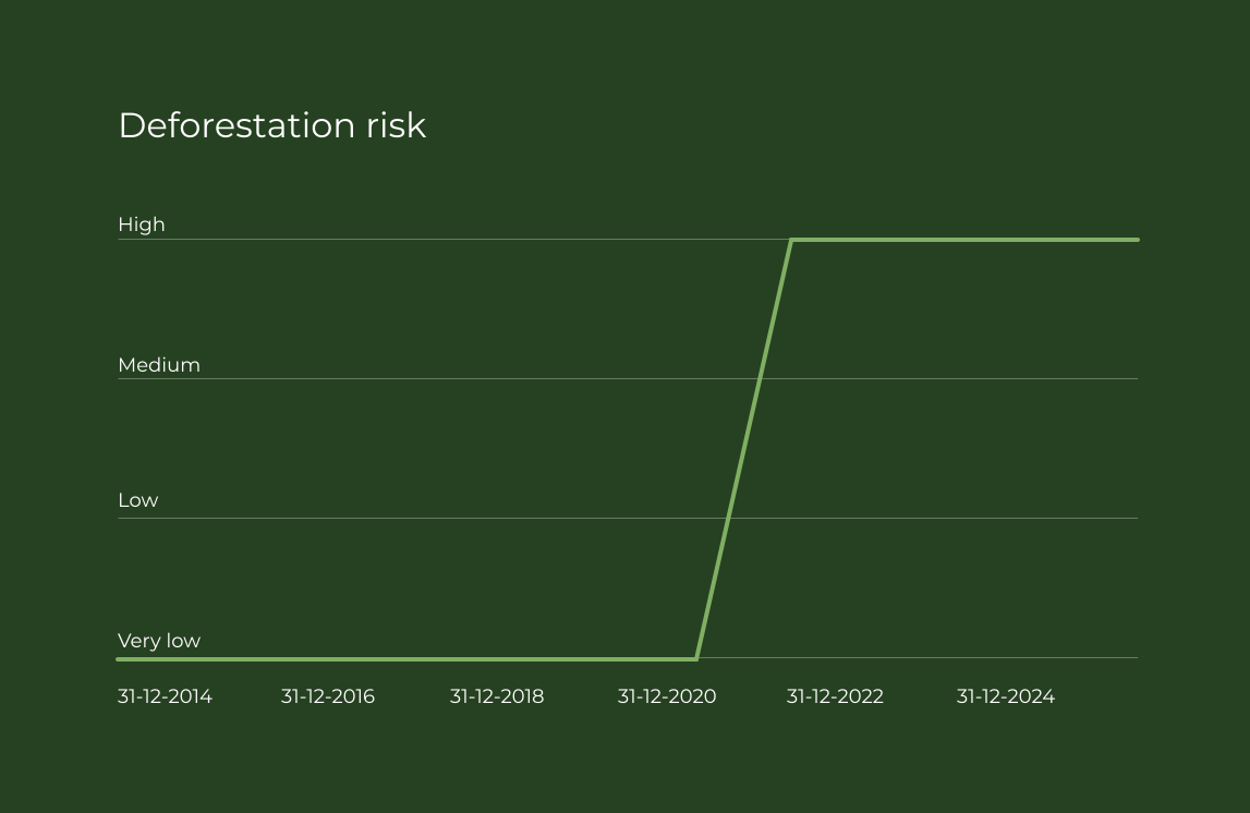
Assess plots against framework-specific requirements using standardized, auditable methodologies aligned with the FAO WHISP approach, with a configurable cutoff date for each framework: December 31, 2020 for EUDR, a rolling window for SBTi FLAG, and 2015 for NDPE.
Produce transparent, traceable reports for auditors, customers, and regulators, with every insight traceable back to source data.
Extend the same plot-level foundation to agroforestry verification, carbon intelligence, and production risk. One platform, many workflows
The EU Deforestation Regulation (EUDR) requires operators to prove that commodities like coffee, cocoa, palm oil, soy, wood, rubber, and cattle are deforestation-free and legally sourced, with plot-level geolocation evidence. Picterra Tracer supports every step: ingesting and verifying supplier geolocation data, assessing deforestation after the regulation’s cutoff date with analysis aligned with the FAO WHISP methodology, classifying risk, and generating a due diligence-ready report and a GeoJSON file formatted for EU TRACES NT, ready to push via API. Submitting the due diligence statement remains the operator’s responsibility. Tracer gives you the audit-ready evidence and formatting that make it defensible.
And because EUDR is one framework among many, the same verified foundation carries your SBTi FLAG targets, NDPE commitments, and customer traceability requests, switching the forest definition and cutoff date per framework instead of starting over for each.

Walter Matter, a century-old, family-owned merchant specialized in coffee and cocoa trading, needed reliable traceability across a global network of smallholder suppliers. With Picterra, their lean team uploads farm data in any format, runs satellite-based deforestation risk assessments, and generates transparent, auditable reports, all without GIS expertise or added operational complexity.
analyzed across 26 countries
managed
verified

Sustainability Manager at Walter Matter SA

From custom detector prototypes to optimized workflows and enterprise integrations, our geospatial and AI experts help your team turn imagery into impact.
Deforestation monitoring is the continuous verification that sourcing plots are free of deforestation and land conversion. Picterra Insights Hub combines satellite observations, plot-level monitoring, and geospatial AI to verify supplier data, detect land-use change, and generate audit-ready evidence across thousands of suppliers, replacing self-reported data and sampled audits with continuous, independent observation. A raw tree-cover-loss alert can mean a plantation harvest, a fire, or genuine forest clearing, so Insights Hub cross-checks each finding across multiple independent forest and plantation layers before it is reported as a defensible risk.
Supplier geolocation data is validated, corrected, and scored on ingestion. Insights Hub checks geometry, attributes, and consistency, applying calibrated quality tests and categorizing records by risk level. As suppliers update their data, verification runs continuously, so your compliance analysis always starts from a reliable foundation.
Insights Hub is framework-ready by design. It supports deforestation-free sourcing evidence for EUDR, SBTi FLAG targets, NDPE commitments, and internal zero-deforestation and conversion-free targets, all from one verified, plot-level evidence base. The same forest and plantation layers are reused across frameworks, with only the forest definition and cutoff date changing to match each one.
For EUDR, Picterra Tracer verifies supplier geolocation data, assesses whether plots are deforestation-free after December 31, 2020 using deforestation and land-conversion analysis aligned with the FAO WHISP methodology, classifies sourcing areas by risk, and generates a due diligence-ready report and a GeoJSON file formatted for EU TRACES NT, ready to push via API. Submitting the due diligence statement remains the operator's responsibility. Continuous monitoring keeps assessments current as your supply base and the regulation evolve.
Yes. Compliance is one of several workflows built on the same intelligence layer. The plot-level monitoring foundation that verifies deforestation-free sourcing also powers agroforestry and regenerative agriculture verification, carbon intelligence, production risk forecasting, and biodiversity insight, so compliance investment compounds instead of sitting in a silo.