What makes regenerative practices verifiable
Regenerative agriculture has moved quickly from niche concept to mainstream commitment. Companies now report on cover cropping, crop rotation, reduced...

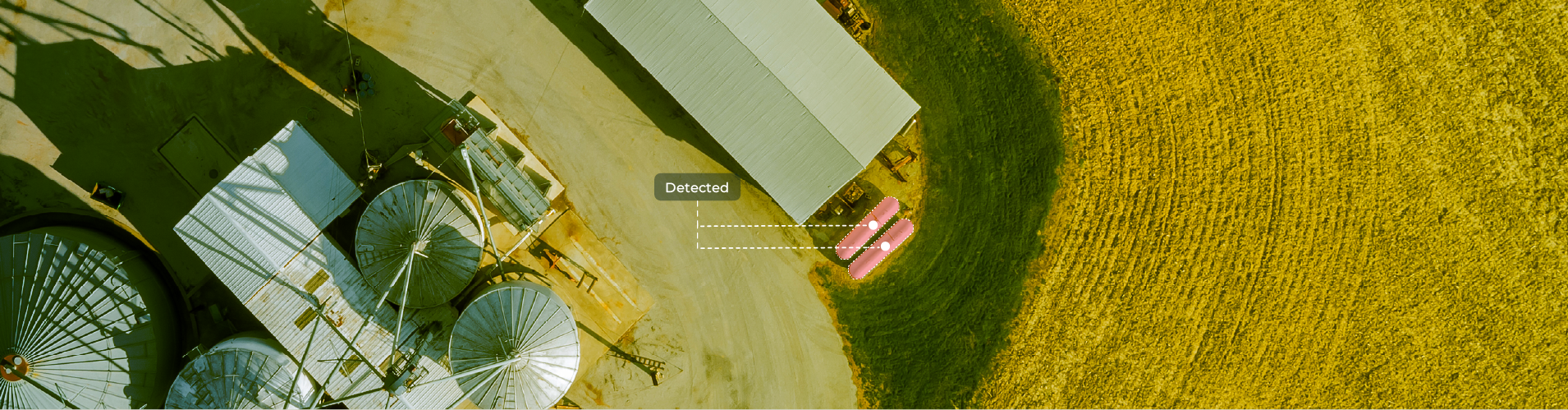
Across agriculture, energy, and industrial operations, tanks are critical assets because they sit at the intersection of regulation, environmental impact, operational risk, and commercial performance. They influence emissions calculations, safety planning, infrastructure investment, and market sizing. In many contexts, knowing how many tanks exist, where they are, and how they are configured is no longer optional. It is a prerequisite for compliance, planning, and informed decision-making.
Yet many organizations still lack a clear, up-to-date view of their tank infrastructure. Inventories are often built from manual surveys, fragmented registries, or self-reported data, making them incomplete or outdated. The result is uncertainty: emissions assessments with blind spots, infrastructure plans based on partial information, and commercial strategies that rely on assumptions rather than evidence.
Most tank inventories rely on manual field surveys, fragmented registries, or self-reported data. These methods may work at a small scale, but they quickly break down across regions or countries. Field inspections are costly and slow to repeat. Records become outdated as infrastructure changes. And self-reported data is often inconsistent or difficult to verify.
As a result, decision-making suffers. Emissions assessments lack precision. Infrastructure planning relies on partial information. Market sizing and growth strategies are built on incomplete visibility. The common issue is not the absence of data, but the lack of a scalable, repeatable way to observe physical infrastructure as it changes over time.
This is the gap that geospatial intelligence is now closing.
What these challenges point to is a broader shift in how organizations can understand and manage physical infrastructure.
Across agriculture, energy, and industry, the core challenge is rarely detection alone. It is the ability to generate consistent, up-to-date, and repeatable inventories across large geographies, and to do so often enough that the data remains relevant. Traditional approaches struggle here. Costs scale linearly with coverage. Update cycles stretch from months to years. And confidence in the underlying data erodes over time.
GeoAI changes that dynamic. By using platforms such as Picterra Forge to automate object-level detection from imagery, organizations can move from one-off mapping exercises to continuous visibility. The same detection logic can be reused across regions, adapted to new resolutions, and rerun as new imagery becomes available.
Just as importantly, detection outputs can be tuned to decision-making needs. In some cases, completeness is prioritized to ensure no assets are missed. In others, higher precision supports streamlined validation. Confidence scores, installation-level footprints, and post-processed datasets allow teams to integrate results directly into environmental models, infrastructure planning, or commercial systems.
The examples that follow show how this plays out in practice, across environmental monitoring, industrial infrastructure mapping, and commercial market intelligence.
Tanks are particularly well-suited to GeoAI because they combine visual consistency with contextual variation. From above, most tanks share recognizable geometric characteristics such as circular shapes, edges, and shadows. At the same time, their appearance varies with size, materials, coverings, surrounding infrastructure, and the landscape. This combination makes them challenging to map reliably using rule-based methods, but well-suited to machine-learning approaches that learn patterns from examples.
GeoAI shifts tank mapping from manual interpretation to object-level detection. Instead of searching for pixels with specific values, models are trained to recognize tanks as discrete objects within high-resolution imagery, even when conditions vary. This is where Picterra Forge comes into play.
In practice, tank detection begins with the ingestion of imagery from aerial or satellite sources, often delivered via WMS services. Resolution is chosen based on the use case. For example, distinguishing covered from uncovered agricultural tanks may require finer detail than identifying large industrial installations.
Detectors are then trained using labeled examples that capture real-world variability. This step is critical, as the model must learn not only what a tank looks like in isolation, but how it appears across different environments and operational contexts. Depending on the objective, detectors can be designed to identify individual tanks, associated components, or entire installation footprints.
Once trained, these detectors can be applied consistently across very large areas, from regional portfolios to country-wide coverage. The outputs are then validated and post-processed for integration into GIS systems, environmental models, or business workflows.
The result is a scalable, repeatable way to generate objective, time-stamped inventories of tank infrastructure, something traditional approaches struggle to achieve.
In 2019, Denmark’s Ministry of Environment needed to urgently calculate national ammonia emissions. A key input was the number of slurry tanks across the country, and whether those tanks were covered, since emission factors differ significantly. No official statistics existed.
The task was assigned to SEGES, which supports Danish farmers and maintains extensive agricultural datasets. Even so, manually counting slurry tanks across more than 34,000 farms was not feasible within the required timeframe.
SEGES used GeoAI with Picterra Forge to automate detection at a national scale. The approach combined 25 cm-resolution imagery covering all of Denmark with known farm locations, focusing the analysis on where slurry tanks are typically found.
A custom detector was trained using just 56 annotated examples across 48 training areas. Despite variations in appearance, including covered and uncovered tanks, the model was able to generalize effectively.
Within a few hours, approximately 26,000 slurry tanks were detected nationwide. The resulting inventory provided a consistent, up-to-date dataset that enabled more accurate estimation of ammonia emissions and informed environmental policy decisions.
For industrial and energy operators, cryogenic tanks are rarely standalone assets. They are part of larger installations that may include vaporizers, piping, safety zones, and shared platforms. As a result, a simple tank count is often insufficient for infrastructure planning, risk assessment, or portfolio oversight.
Using Picterra Forge, GeoAI was applied to detect cryogenic tank infrastructure across multiple regions, starting with a detailed analysis of Spain. An initial reference dataset of known tank locations was used to train and validate detection models, with a deliberate decision to prioritize recall over precision. In this context, missing tanks posed a greater operational risk than reviewing a small number of false positives.
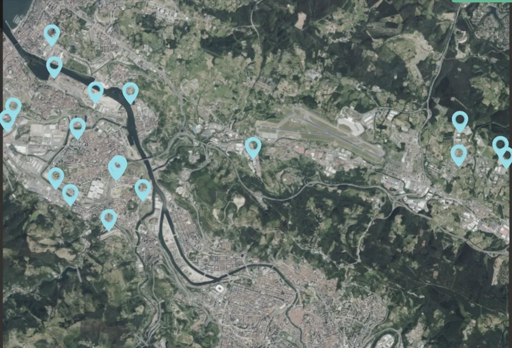
Rather than relying on a single model, multiple detectors were trained to capture different levels of detail. One focused on individual tanks, while another detected full installation footprints, accounting for variations such as single- or multiple-tank configurations and the presence or absence of vaporizers. Confidence scores were used to streamline quality control and validation.
Once validated, the models proved transferable across geographies and imagery resolutions, enabling consistent detection across multiple European countries. Notably, the detectors also identified previously unknown installations, highlighting the limits of existing asset inventories and the value of repeatable, large-scale geospatial analysis.
For propane service providers, understanding the actual size and distribution of the commercial market is a persistent challenge. Existing customer lists and registries rarely reflect the whole picture, particularly across large rural areas where infrastructure is dispersed, and records are incomplete.
Using Picterra Forge, GeoAI was applied to automatically identify propane tanks across eight US Midwest states. High-resolution imagery was analyzed to detect both covered and uncovered tanks at scale, creating a consistent view of where commercial propane infrastructure was actually located.
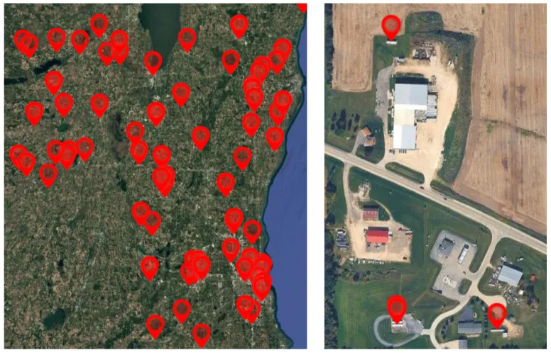
The value of the project extended beyond detection. Results were post-processed and enriched to produce structured, CRM-ready outputs, including addresses and contact details associated with detected installations. This allowed the dataset to plug directly into existing sales and operations workflows, rather than remaining a static map.
By turning imagery into market intelligence, the project enabled a shift from assumption-based planning to data-driven decision-making. Instead of estimating demand from partial records, teams gained objective visibility into commercial assets across their territory, supporting more targeted growth strategies and resource allocation.
Together, these examples show how tank detection moves from a technical exercise to a strategic capability when it can be applied consistently and at scale. Whether the goal is emissions monitoring, infrastructure oversight, or market intelligence, the value lies in having reliable, repeatable visibility into physical assets as they change over time. GeoAI provides the foundation for that shift, turning high-resolution imagery into evidence that organizations can trust and use to make better decisions.
Regenerative agriculture has moved quickly from niche concept to mainstream commitment. Companies now report on cover cropping, crop rotation, reduced...
For many organizations, biodiversity has long sat alongside climate as an important but difficult topic. Companies have made commitments, published...
Compliance expectations across agricultural and forest risk supply chains have shifted quickly. Regulations and voluntary frameworks now require specific, defensible...

The unseen contamination risk in leafy greens Leafy greens sit at the frontline of food safety. Because they are harvested...