Turning biodiversity data into decisions: insights from our live with IBAT
For many organizations, biodiversity has long sat alongside climate as an important but difficult topic. Companies have made commitments, published...

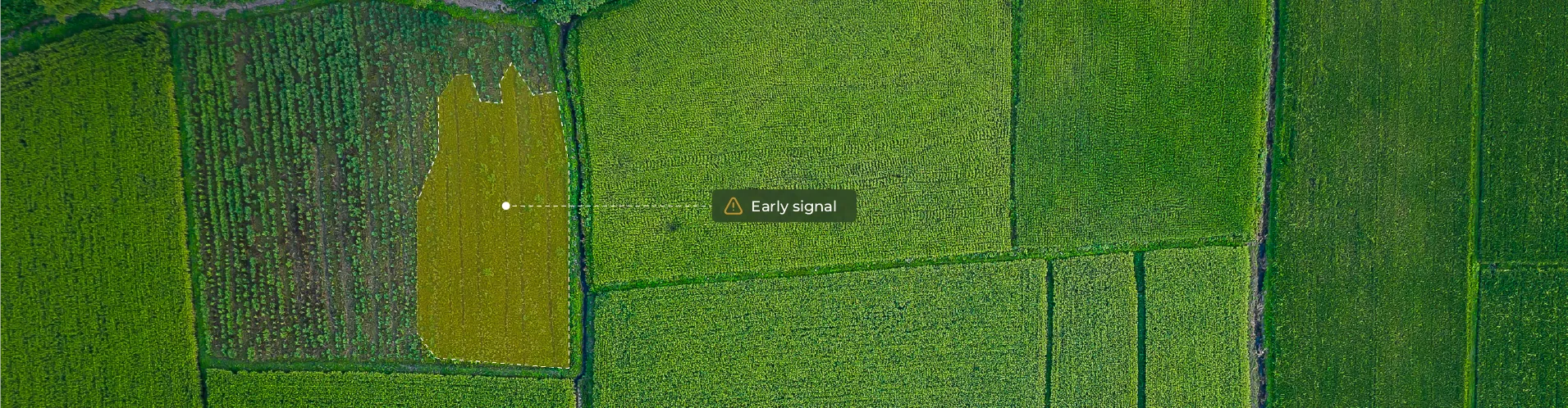
Regenerative agriculture has moved quickly from niche concept to mainstream commitment. Companies now report on cover cropping, crop rotation, reduced tillage, and integrated systems as indicators of soil health and climate resilience. Investors and regulators are beginning to ask not just whether these practices are encouraged, but whether they are actually implemented at scale.
Most verification systems, however, were not designed for dynamic land management practices. They rely heavily on self-reporting, certification audits, and periodic field inspections. These approaches can confirm that a policy exists or that a farm met a standard at a specific moment in time. They are less effective at detecting whether a practice is consistently applied across seasons or quietly erodes over time.
The challenge is not intent. It is observability. Regenerative practices are seasonal, adaptive, and highly dependent on timing. A field may appear compliant during an inspection, but follow a different management pattern before or after that visit. Without continuous, location-specific evidence, verification becomes episodic rather than structural.
The key question, therefore, is not whether regenerative practices can be defined. It is whether they can be independently observed and measured in a consistent, reproducible way.
Many regenerative practices are not abstract principles. They alter the physical and biological condition of the land surface. Changes in vegetation cover, residue retention, planting timing, and biomass structure all influence how a field reflects light, retains moisture, and evolves across a growing season.
These shifts create observable patterns. A field that maintains continuous cover behaves differently over time than one left bare between cycles. A rotated cropping system produces distinct seasonal growth curves compared to temporal monoculture, where the same crop is planted repeatedly on the same land. Residue retained after harvest modifies the spectral response of the soil surface. Integrated systems that combine trees, crops, or livestock introduce structural complexity that can be detected in vegetation density and layering.
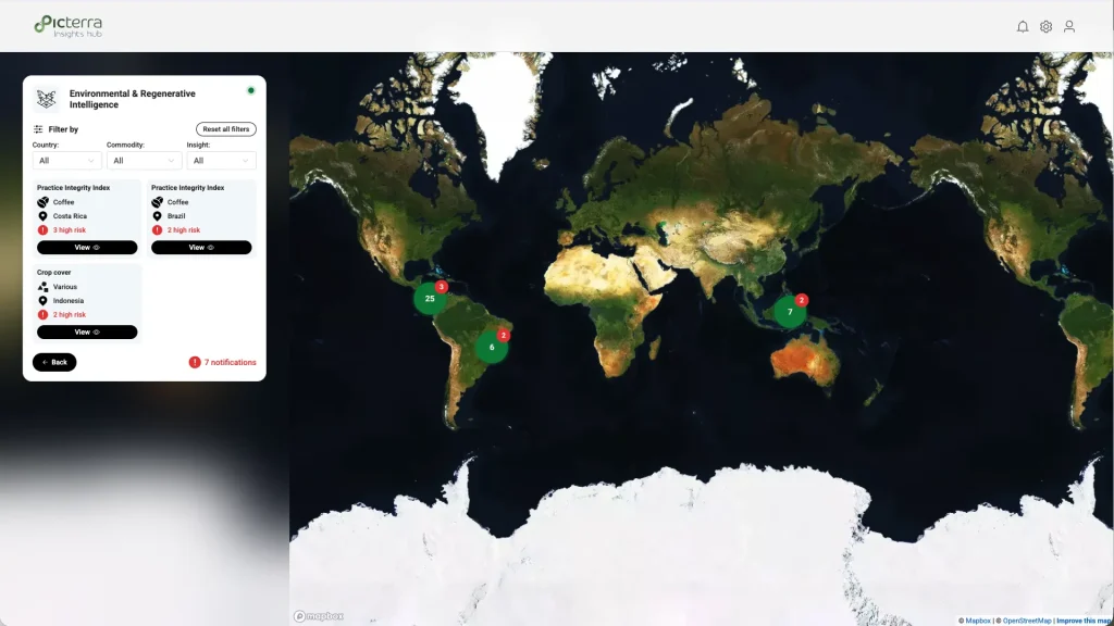
When analyzed through multitemporal satellite data and consistent geospatial models, these differences become measurable signals rather than anecdotal claims. The value does not come from a single image. It comes from time-series analysis, standardized indicators, and a transparent analytical logic applied consistently across seasons and regions.
This shift changes the verification baseline. Instead of asking whether a practice was declared, we can ask whether land behavior over time aligns with the expected signature of that practice.
Some regenerative practices produce clear, repeatable signals that can be verified with high confidence when analyzed over time.
Cover cropping is one of the most observable examples. The core indicator is permanent green cover. Vegetation indices and fractional green cover metrics can verify whether soil remains covered during periods when it would otherwise be bare. Satellites are designed to detect vegetation, so if a field remains green during a window that is typically brown, that signal is relatively straightforward to measure. The key is to define a consistent “green cover window” and evaluate it across seasons, rather than relying on a single image.
Crop rotation can also be verified through phenological diversity. Different crops exhibit distinct growth cycles and spectral signatures. By analyzing multitemporal data across planting and harvest periods, it becomes possible to detect whether a field follows a repeating monoculture pattern or displays alternating seasonal signatures consistent with rotation. This requires time series analysis but remains methodologically robust when applied consistently.
In both cases, verification depends less on a snapshot and more on detecting structured seasonal patterns that align with expected land management behavior.
Not all regenerative practices produce signals that are easy to interpret. Some require more advanced sensors, tighter calibration, and careful separation of similar spectral responses.
Reduced-tillage or no-till practices are a good example. The relevant indicator is crop residue retained on the soil surface after harvest. Residue protects soil from erosion and supports moisture retention, but distinguishing dead organic matter from dry, light colored soil is not trivial. Both can appear similar in standard optical imagery. Reliable detection often requires short-wave infrared bands, radar data, or texture analysis to differentiate residue cover from exposed soil. The analytical burden is higher, and model transparency becomes critical.
Integrated systems introduce another layer of complexity. When trees, crops, and livestock share the same space, the land surface becomes vertically stratified. Dense tree canopies can obscure what is happening at ground level, including overgrazing or bare soil. Verifying these systems may require higher-resolution data, specialized sensors, or complementary technologies, such as LiDAR, to capture structural complexity.
Greater complexity does not make verification impossible, but it does require clearer methodology and appropriate sensor selection.
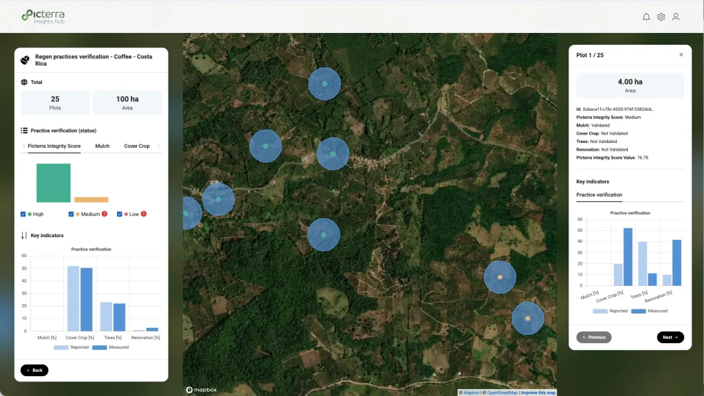
Credible verification does not only depend on detecting signals. It also depends on actively testing alternative explanations. Many regenerative indicators can be misread if evaluated without context or temporal consistency.
In cover cropping, spontaneous weeds or invasive species can create a green field that resembles a deliberately planted cover crop. A single image may suggest compliance. Multitemporal analysis is needed to confirm that green cover appears within a defined planting window and follows a repeatable seasonal pattern. This is where the concept of a green cover window becomes important.
Reduced tillage presents a different ambiguity. Dry, light colored soil can resemble crop residue in optical imagery. To avoid misclassification, additional indicators such as radar-based moisture signals or short-wave infrared analysis can help distinguish residue from exposed soil.
Crop rotation can also be misinterpreted if volunteer plants from a previous season emerge and mimic a new crop. High-resolution imagery and row pattern consistency checks help confirm whether a true rotation occurred.
Integrated systems require caution as well. Dense tree canopies may hide bare soil or overgrazed areas beneath them. Specialized sensors or canopy gap analysis are often needed to verify ground conditions.
Responsible verification means acknowledging where ambiguity exists and designing methods that reduce it rather than ignoring it.
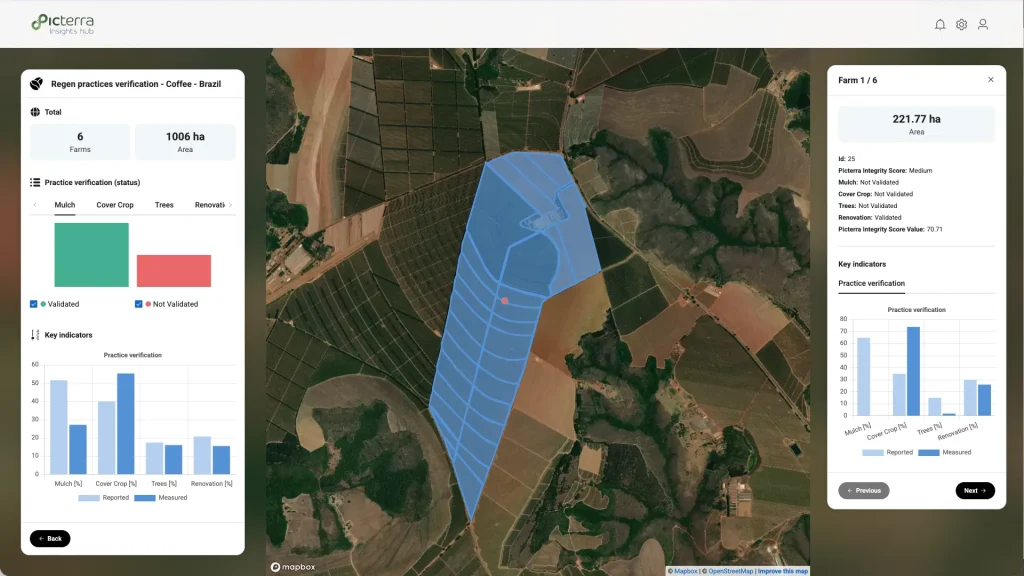
Regenerative practices cannot be reliably verified from a single image. A field may look compliant on a given day and still follow a declining trajectory over multiple seasons. Meaningful verification depends on trends.
Consider cover cropping. In a single snapshot, a field covered in green biomass appears healthy. Over several seasons, however, the same field may show biomass levels consistently below a five-year baseline. The green cover window may also be shrinking, with soil exposed earlier each year. The surface appears compliant in isolation, but long-term productivity signals tell a different story.
Tillage practices show a similar pattern. A brown, bare field at harvest does not immediately reveal whether reduced tillage is applied. Time series analysis can show how quickly the field returns to green, how much residue persists, and whether soil exposure is shortening or expanding across seasons.
Verification is therefore less about appearance and more about trajectory. Continuous monitoring enables assessment of whether regenerative practices are stable, improving, or gradually eroding.
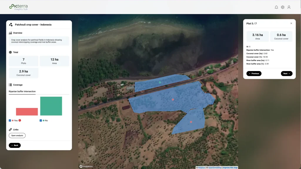
Translating those trajectories into defensible evidence requires more than imagery alone. It requires models configured for the specific crop, practice, and local conditions, combining spectral, temporal, and structural signals into a coherent assessment. Picterra solutions are designed with these factors in mind, ensuring that verification frameworks reflect agronomic reality rather than generic thresholds.
Through Picterra Insights Hub, these signals can be made transparent and accessible, turning complex time series analysis into structured, inspection-ready evidence. Practice verification moves from a checkbox exercise to measurable, long-term behavior.
For many organizations, biodiversity has long sat alongside climate as an important but difficult topic. Companies have made commitments, published...
Compliance expectations across agricultural and forest risk supply chains have shifted quickly. Regulations and voluntary frameworks now require specific, defensible...
Across agriculture, energy, and industrial operations, tanks are critical assets because they sit at the intersection of regulation, environmental impact,...

The unseen contamination risk in leafy greens Leafy greens sit at the frontline of food safety. Because they are harvested...