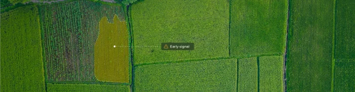
What makes regenerative practices verifiable
Regenerative agriculture has moved quickly from niche concept to mainstream commitment. Companies now report on cover cropping, crop rotation, reduced...


Compliance expectations across agricultural and forest risk supply chains have shifted quickly. Regulations and voluntary frameworks now require specific, defensible proof of what is happening on the ground. General assurances and annual summaries are no longer enough. Evidence must be tied to location and timing and reproducible.
Many compliance processes, however, still rely on supplier self-reporting, periodic audits, and manually assembled documentation. These methods were designed for lower scrutiny and slower change. They work reasonably well for policy checks and process reviews, but they are weak at detecting land change events, boundary breaches, or mid-season conversion.
This creates a structural visibility gap. Companies are expected to stand behind claims about deforestation-free sourcing, protected-area compliance, and land-use history, yet the supporting evidence is often fragmented across systems and time periods. By the time issues are discovered, the product may already be in the chain.
The core constraint is not intent. It is observability. Modern compliance increasingly depends on independent, time-stamped, location-specific evidence rather than retrospective reconstruction.
A growing share of supply chain compliance questions are, at their core, land questions. They concern what happened on a specific piece of land, where and when it happened. For deforestation, land conversion, and protected area encroachment, the answers are written into the land surface itself.
What has changed in recent years is the ability to consistently observe and reconstruct those changes. Satellite archives now provide multi-year, time-stamped records of vegetation cover, land use patterns, and surface disturbance. Combined with geospatial analysis methods, this enables us to reconstruct land history rather than relying solely on declarations about it.
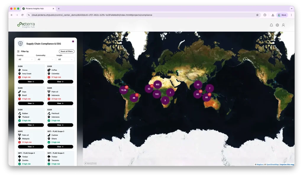
This does not replace audits or documentation. It changes the evidentiary baseline. Instead of starting from reported status and sampling a subset of sites, compliance teams can begin with wall-to-wall observation and then validate exceptions and edge cases more efficiently.
This shift is also why transparency in methodology is becoming increasingly important in compliance intelligence. When evidence is derived from repeatable remote sensing signals and documented analytical logic, findings can be checked, reproduced, and challenged in a structured way, rather than treated as black-box conclusions.
Remote sensing is not a universal compliance tool, but when combined with strong analytical models and time series methods, it offers solid, independently verifiable evidence for specific indicators. The most reliable signals are those connected to measurable land surface change over time, where model-driven analysis of satellite data shows a clear before-and-after pattern with a dependable timestamp.
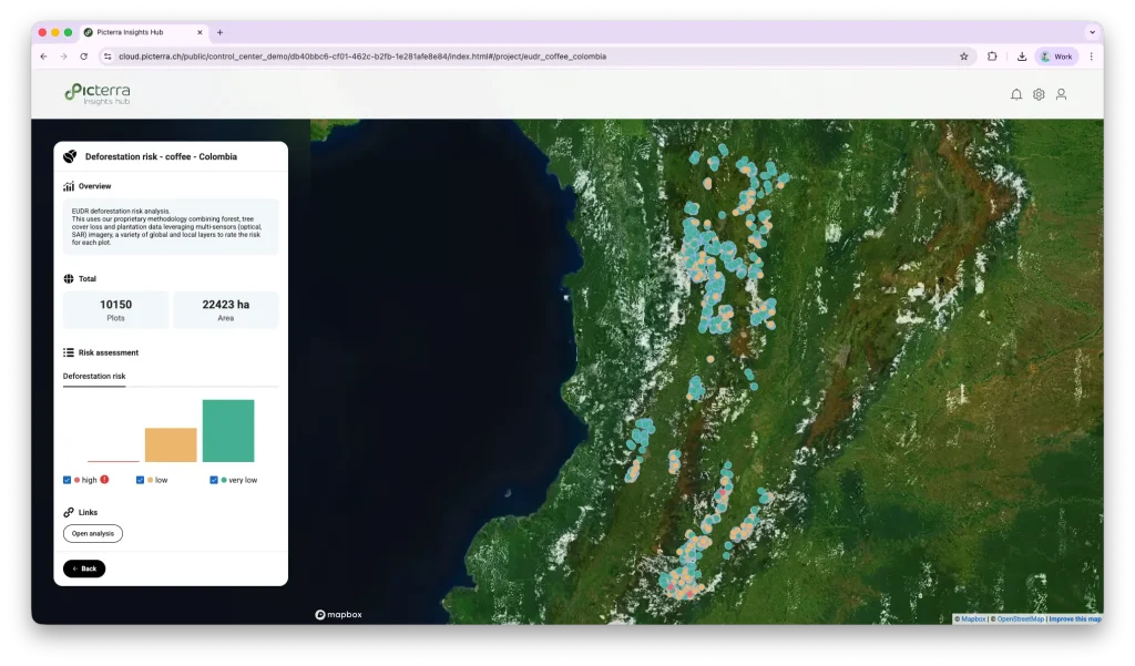
This includes the timing of land use change and deforestation. Detection models analyze spectral and structural signals across imagery archives to identify when forest cover is replaced by crops or bare soil. Because these methods are applied consistently across multi-year datasets and can be cross-checked with different sensor types, including optical and radar, both the event and its timing can be reliably established, even relative to regulatory cutoff dates. Declines in vegetation structure and forest loss follow a similar analytical logic.
Model-based time series analysis also provides a reliable way to classify crop presence and ensure phenology consistency. Annual cycles, double cropping patterns, and fallow versus active cultivation create distinct temporal signatures that can be identified and confirmed using historical baselines.
Encroachment into protected areas and buffer zones is another strong example, where spatial models combine boundary datasets with detected land change to produce assessments of low ambiguity overlap.
In these domains, remote sensing answers three critical compliance questions with high confidence: what changed, where, and when.
The strength of satellite-based compliance evidence lies in its precision about its limits. Not every sustainability or regulatory requirement yields a clear land-surface signal, and treating remote sensing as all-seeing creates risk rather than reducing it.
Some indicators are only partially defensible from satellite data and require hybrid verification. Degradation versus legal clearing is one example. A canopy may thin without fully disappearing, but distinguishing permitted activity from harmful disturbance often depends on management context and permits. Selective logging and understory disturbance can also be difficult to confirm when changes occur below the top canopy layer or at a scale smaller than sensor resolution.
Indirect supplier leakage presents a different limit. If production from non-compliant areas is mixed through intermediaries, the issue is in the chain of custody, not the land surface. No sensor can see commercial flows or blending.
Other compliance domains require ground truth and records by definition. Land tenure, legal authorization, environmental licenses, labor conditions, pesticide use, and management practices must be verified through registries, documents, and inspections.
Clear scope boundaries make compliance evidence more defensible. Satellites show land signals. Documentation shows legal and operational status.
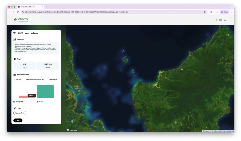
Compliance evidence derived from remote sensing should be expressed with quantified confidence, not absolute certainty. Detection models do not produce verdicts. They produce probabilistic signals based on spatial resolution, temporal coverage, and model performance. A reported confidence score reflects known sources of uncertainty, such as pixel mixing, cloud gaps, and sensor limits. Stating that uncertainty clearly strengthens defensibility rather than weakening it.
Best practice is layered verification. Satellite-based detection establishes where and when a change is likely to occur. Legal records, supplier documentation, and targeted field checks then confirm authorization, responsibility, and context. This combined approach avoids both overclaiming and blind spots.
Confidence is also closely tied to plot-level continuity. Compliance exposure is determined at the level of individual plots over time, not farm level annual averages. Deforestation can occur mid-season on a single polygon while other plots remain compliant. Without continuous plot tracking, non-compliant production can be mixed with compliant supply and discovered too late.
With stable plot boundaries and time series monitoring, risk can be flagged early, sourcing can shift, and evidence is ready when questions arise.
Taken together, these shifts indicate a broader shift in how compliance is built and defended. The traditional model is periodic and reactive. Evidence is gathered during the audit, assembled from multiple sources, and often reconstructed after questions are raised. That approach is increasingly fragile under tighter regulatory timelines and higher proof standards.
A newer model is continuous and evidence-led. Land-based signals are monitored over time, plot by plot, with methods that are repeatable and transparent. Remote sensing provides the what, where, and when. Documentation and field validation provide the who and why. Compliance evidence is accumulated steadily rather than produced on demand.
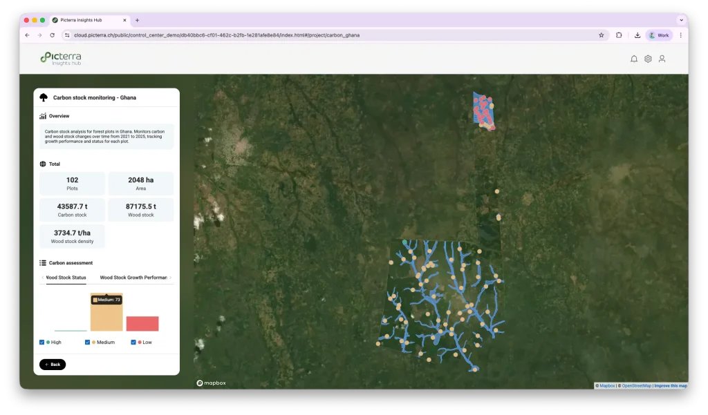
This is the operating logic behind emerging compliance intelligence approaches and platforms, such as Picterra Insights Hub, which combines plot-level geospatial analysis, time-stamped imagery, and standardized methods to support defensible assessments at scale.
As methodology, data sources, and analytical logic become more openly documented through public insight programs, compliance conversations start to shift. The focus moves from claims and questionnaires toward observable, reproducible evidence that can be examined and verified.
Regenerative agriculture has moved quickly from niche concept to mainstream commitment. Companies now report on cover cropping, crop rotation, reduced...
For many organizations, biodiversity has long sat alongside climate as an important but difficult topic. Companies have made commitments, published...

Across agriculture, energy, and industrial operations, tanks are critical assets because they sit at the intersection of regulation, environmental impact,...

The unseen contamination risk in leafy greens Leafy greens sit at the frontline of food safety. Because they are harvested...